RECAP: Messy winter storm brings snow, rain to Toronto region
A winter storm brought snow and rain to the Greater Toronto Area and parts of southern Ontario Tuesday, creating wet and slushy road conditions for drivers.
The day began with snowfall before transitioning to rain later in the afternoon.
There were no significant travel delays or collisions on Tuesday as the storm moved through the region.
Rain is expected to end overnight. It will be cloudy on Wednesday with a high of 2 C and a 60 per cent chance of showers or flurries.
Here’s a recap of our coverage of Toronto’s first winter storm of 2024.
5 p.m.
Rain continues to fall in the Greater Toronto Area, making for a wet and slushy drive on highways and local roads.
Ontario Provincial Police (OPP) have responded to dozens of collisions today.
"Most of them are just single vehicles into the walls – they get caught in the slush, or they lose control (and) they hit cars in front of them," OPP Sgt. Kerry Schmidt says.
"It's just a sloppy, slushy mess out there right now. It's gonna continue to be like that through the afternoon rush and into the overnight hours, so, you know, be prepared for a wet, sloppy day or evening of driving conditions."
He adds that there has been a steady stream of tow trucks and "tangled up cars" coming at collision reporting centres.
Drivers who are involved in a collision should get off the highway as quickly as possible and go somewhere safe, especially if their vehicle is still drivable, Schmidt says.
"Because if you lost control in one area and you stopped there and you get out of your vehicle, you're putting yourself in huge jeopardy because of the potential of another car doing exactly the same thing," he says.
Given the weather conditions, Schmidt says drivers should give themselves time and space while on the highway.
"We just want to remind people that things happen quickly, and if you're not paying attention 100 per cent, you know, you can get caught by surprise," he says. "A little bit of slush can send you overreacting into other traffic, and all of a sudden, you're just trying to hit the brakes, and you end up hydroplaning or just sliding across this wet, slushy highway."
3:30 p.m.
Snow has transitioned to rain, which could make for a slushy drive for motorists.
A rainfall warning remains in effect for Toronto and the rest of the Golden Horseshoe, advising of 20 to 35 millimetres of rain this afternoon and evening.
“The frozen ground has a reduced ability to absorb this rainfall,” the federal agency said, adding that ponding of water on the roads is expected.
The rain is expected to end overnight.
According to the Toronto and Region Conservation Authority (TRCA), flooding is not expected in watersheds, but because of the expected rainfall amount, rivers within the GTA may experience higher than normal water levels and greater flows for a couple of days.
“The combination of snow, ice, rain and changing water levels could create hazardous conditions near rivers or other water bodies and slippery or unstable banks,” the TRCA said in its advisory.
“All shorelines, rivers and streams within the GTA should be considered dangerous as this rainfall will result in higher flows and rapidly changing water levels.”
2 p.m.
Toronto police say roads have been more or less "normal" so far today in terms of the volume of collisions. But they are still reminding people to expect the unexpected on the roads amid a mix of messy weather that includes snow, ice pellets and rain.
"Leave extra space, give yourself extra time, and you know the biggest thing is again, speed. If you're going too fast, you're setting yourself up for failure," Constable Sean Shapiro told CP24. "That's where we see people losing control and sliding because it takes longer to slow down and come to a stop in the slippery conditions and things may change.
- IN PHOTOS: Toronto's first winter storm of 2024
"You know we have the slush now; We drop a couple of degrees, we may have ice again and it really changes the dynamics of the way your vehicle is going to handle."
Those who are involved in a minor collision should exchange information and head to a collision reporting centre if the vehicles are drivable, Shapiro said. Police will attend more serious collisions where there are injuries or criminality involved.
Some other tips for drivers:
- Stock up on windshield washer fluid
- Have kitty litter in the trunk to help get out of a situation where your vehicle gets stuck.
- Make sure to have warm clothes with you in case your vehicle does get stuck and you need to wait for help
11:45
The city says that it will open walk-in warming centres today at 5 p.m. for anyone experiencing homelessness who needs relief from the weather. The centres offer a warm place to rest and access to snacks, washrooms and referrals to emergency shelters.
The warming centres are located at:
- 136 Spadina Rd. (south of Dupont St.)
- 75 Elizabeth St. (behind City Hall; west of Bay St., south of Dundas St. W.)
- North York Warming Centre, 15 Olive Ave. (east of Yonge St., south of Finch Ave. E.)
- 885 Scarborough Golf Club Rd. (east of Markham Rd., South of Ellesmere Rd.)
More information on information on drop-ins and warming centres can be found on the city's website.
11:30 a.m.
The TTC says that it is adding extra staff and maintenance vehicles across the transit system in order to make sure that its vehicles keep running today.
The transit agency also says that it will be actively monitoring 56 bus stops in areas where heavy snow and freezing rain might make it difficult for vehicles to operate. Riders are being advised to check if their stop is in service before they travel.
Wheel-Trans service is operating today but the TTC says that customers may experience longer wait times and delays.
Meanwhile, the OPP are offering some further tips for drivers:
10:30 a.m.
Toronto police are urging drivers to use extra caution on the roads as the storm begins.
"Toronto is expecting a winter storm today. Please use caution if you must venture outside," the force said in a statement on X. "Drivers: slow down and drive to the weather conditions. Stay safe, everyone."
9:45 a.m.
Snow has begun to fall in downtown Toronto. According to CP24 Meteorologist Bill Coulter, heavier wet snow will continue to fall until around 2 p.m. in the early afternoon.
"Then the heavier wet snow changes over along the lake shore to rain," Coulter said. "It takes a little longer at Pearson, probably closer to 4 p.m., to change the rain. And then we all see the temperature rise to about 4 C at Pearson and then we get the rain up until about midnight."
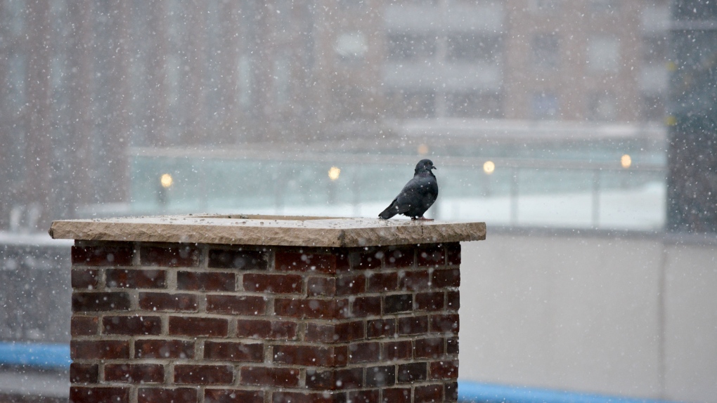 A pigeon gets warm atop a chimney as snow falls in downtown Toronto Tuesday January 9, 2024. (Joshua Freeman /CP24)
9:30 a.m.
Environment Canada issued a significant rainfall warning mid-Tuesday morning, saying that between 20 and 35 mm of water is expected to fall in the Toronto area.
Precipitation is expected to change from snow to rain in the afternoon or early evening, according to the warning.
“The frozen ground has a reduced ability to absorb this rainfall,” the weather agency said. “Localized flooding in low-lying areas is possible. Heavy downpours can cause flash floods and water pooling on roads.”
7:45 a.m.
Ontario Provincial Police are urging people to be mindful of the weather today as they set out on the roads.
Speaking with CP24, OPP Sgt. Kerry Schmidt said the mix of rain and snow that’s expected could be deceiving for some drivers in terms of what to expect.
"We're also expecting potentially heavy rain which could result in ponding and that can also have hydroplaning effects and obviously loss of control if you start skipping across the water," Schmidt said. "So make sure you're driving according to those conditions. You see open water, you see ponding or you see snow and ice on the roads, just as slow down, give yourself time."
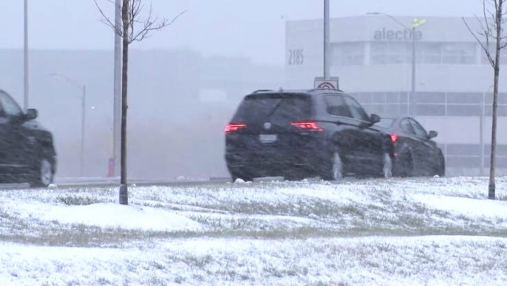 Snow is seen falling in Mississauga on Jan. 9 as a messy mix of winter weather began to hit the GTA.
He also noted that weather conditions are expected to vary across the GTA, so people should be prepared for changing road conditions as well and exercise caution.
"If you're driving across the region, you may be driving from rain to ice to snow and you never know what the roads gonna look like when you have to hit the brakes," Schmidt said.
7 a.m.
Toronto Pearson International Airport says it is monitoring the developments around the storm. The airport is advising people to leave extra time to get to the airport and to check their flight status online before leaving.
6:15 a.m.
A number of school bus cancellations have been announced in some parts of the GTA and southern Ontario. In most cases, schools remain open for learning, even if buses are cancelled. The TDSB says cancellations are not expected in Toronto. You can find a full list of school bus cancellations here.
6 a.m.
Conditions remain clear in Toronto early this morning and no weather problems are anticipated for the morning rush. However a winter weather travel advisory is in effect for today.
Environment Canada says Toronto could see snowfall amounts of 5 to 10 cm and hazardous travel conditions are possible beginning late this morning in the GTA and lasting through this evening.
The agency says the GTA could see heavy snow at times as the storm system moves through Southern Ontario. Snow is expected to change to rain later in the day, with as much as 20-30 mm expected.
Snowfall amounts could be significantly lower closer to Lake Ontario.
"Difficult travel conditions will be likely once the snow arrives. At this point, it appears that the heaviest snow will arrive after the morning commute, but that the afternoon commute could be significantly impacted," the agency said in its statement. "Motorists should expect hazardous winter driving conditions and adjust travel plans accordingly. Surfaces such as highways, roads, walkways and parking lots may become difficult to navigate due to accumulating snow."
CTVNews.ca Top Stories

'She will not be missed': Trump on Freeland's departure from cabinet
As Canadians watched a day of considerable political turmoil for Prime Minister Justin Trudeau and his government given the sudden departure of Chrystia Freeland on Monday, it appears that U.S. president-elect Donald Trump was also watching it unfold.
Canadian government to make border security announcement today: sources
The federal government will make an announcement on new border security measures after question today, CTV News has learned.
Two employees charged in death of assisted care resident who ended up locked outside building overnight
Two employees at an Oshawa assisted living facility are facing charges in connection with the death of a resident who wandered outside the building during the winter and ended up locked outside all night.
The Canada Post strike is over, but it will take time to get back to normal, says spokesperson
Canada Post workers are back on the job after a gruelling four-week strike that halted deliveries across the country, but it could take time before operations are back to normal.
Lion Electric to file for creditor protection
Lion Electric, a Quebec-based manufacturer of electric buses and trucks, says that it plans to file for creditor protection.
Canada's inflation rate down a tick to 1.9% in November
Inflation edged down slightly to 1.9 per cent in November as price growth continued to stabilize in Canada.
Transit riders work together to rescue scared cat from underneath TTC streetcar
A group of TTC riders banded together to rescue a woman's cat from underneath a streetcar in downtown Toronto, saving one of its nine lives.
Trudeau considering his options as leader after Freeland quits cabinet, sources say
Chrystia Freeland, Canada's finance minister, said in an explosive letter published Monday morning that she will quit cabinet. Here's what happened on Monday, Dec. 16.
Teacher and a teenage student killed in a shooting at a Christian school in Wisconsin
A 15-year-old student killed a teacher and another teenager with a handgun Monday at a Christian school in Wisconsin, terrifying classmates including a second grader who made the 911 call that sent dozens of police officers rushing to the small school just a week before its Christmas break.


