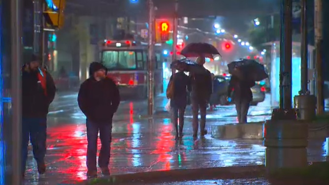
More than a dozen pedestrians were struck by vehicles as heavy rain led to reduced visibility in Toronto.
"We have had numerous pedestrians struck this am. PLS SLOW DOWN," Toronto police tweeted early Wednesday morning.
Officers wrote that the rain and darkness meant drivers were unable to see the injured pedestrians as they crossed the road. Ten collisions involving pedestrians were reported across the city between 6 a.m and 8:10 a.m. Another three pedestrians had been struck by noon.
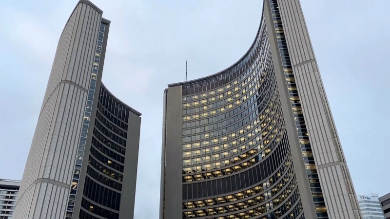
The rain also caused a temporary closure of the York Street ramp from the eastbound Gardiner Expressway, but flooding has since cleared and the ramp has reopened.
The heavy rain falling in Toronto and the surrounding area is part of a storm system dumping the rainy remnants of hurricane Patricia on the Golden Horseshoe.
The low-pressure system formed in Louisiana, sweeping up the moisture left over from the strongest storm ever recorded in the Western Hemisphere.
The storm system headed north, intensifying over the Great Lakes, Environment Canada said in a special weather statement.
The air mass brought strong, gusty winds and heavy rain to the Greater Toronto and Hamilton area early Wednesday morning. The rain and wind are expected to continue until Friday, the weather agency warned.
The storm is expected to dump between 25 and 40 millimetres of rain, though some areas are under a rainfall warning of up to 55 millimetres. A rainfall measurement sent by Environment Canada on Wednesday afternoon said 44 millimetres of rain had fallen in the downtown area as of 2 p.m.
The warnings have been issued for an area from London to Kingston.
Wind gusts are expected to reach 70 km/h in most areas, though stronger winds are expected near the eastern ends of Lakes Erie and Ontario. Gusts could reach up to 90 km/h in areas under a windfall warning.
The wind may be strong enough to cause tree damage and power outages, Environment Canada said.
Residents of the Toronto area are advised to be careful near waterways. The Toronto and Region Conservation Authority issued a statement ahead of the storm, warning of "higher than normal" water levels and flows.
"Rivers and streams will be faster flowing, creating unsafe and/or dangerous conditions," the statement said.
The TRCA also warned there may be flooding on roadways and low-lying areas during the storm. The organization will be monitoring streams and weather conditions carefully until the storm has passed.
The following areas fall under an Environment Canada rainfall warning:
- Toronto
- York-Durham
- Halton-Peel
- Hamilton
- Niagara
- Simcoe-Delhi-Norfolk
- Belleville-Quinte-Northumberland
- Peterborough-Kawartha Lakes
- Stirling-Tweed-South Frontenac
- Oxford-Brant
- Waterloo-Wellington
- Dufferin-Innisfil
- Dunnville-Caledonia-Haldimand
- Kingston-Prince Edward
The following areas fall under an Environment Canada wind warning:
- Niagara
- Simcoe-Delhi-Norfolk
- Elgin
- Dunnville-Caledonia-Haldimand
- Kingston-Prince Edward
- Belleville-Quinte-Northumberland
The following areas fall only under Environment Canada's special weather statement:
- Barrie-Orillia-Midland
- Grey-Bruce
- Algonquin
- Haliburton
- Parry Sound-Muskoka
- Bancroft-Bon Echo Park
- Burk's Falls-Bayfield Inlet
- Smiths Falls-Lanark-Sharbot Lake
- Brockville-Leeds and Grenville
- Ottawa
- Prescott and Russell
- Cornwall-Morrisburg
- Renfrew-Pembroke-Barry's Bay
- Windsor-Essex-Chatham-Kent
- Sarnia-Lambton
- Elgin
- London-Middlesex
- Huron-Perth

