A storm system heading north from the U.S. is expected to dump the rainy remnants of hurricane Patricia on the Toronto area.
The low-pressure system formed in Louisiana, sweeping up the moisture left over from the strongest storm ever recorded in the Western Hemisphere.
The storm is heading north, and expected to intensify as it reaches the Great Lakes, Environment Canada said in a special weather statement issued Monday, and renewed Tuesday morning.
As the air mass approaches, it is expected to bring strong, gusty winds and "significant" rainfall to the Greater Toronto and Hamilton Area, the weather agency warned.
The agency also issued a rainfall warning for Toronto and surrounding regions on Tuesday afternoon.
Between 45 and 55 millimetres of rain are expected to fall on the region.
Environment Canada is warning that “hazards may include power outages due to heavy downpours causing tree limbs to fall on power lines.”
The storm is expected to reach southern Ontario Tuesday evening, and blanket the Golden Horseshoe area between Toronto and Hamilton by Wednesday morning. It will then head into central and eastern Ontario through the day, Environment Canada predicts.
When the rain begins, residents of the Toronto area are advised to be careful near waterways. The Toronto and Region Conservation Authority issued a statement warning of "higher than normal" water levels and flows.
"Rivers and streams will be faster flowing, creating unsafe and/or dangerous conditions," the statement said.
The TRCA also warned there may be flooding on roadways and low-lying areas during the storm. The organization will be monitoring streams and weather conditions carefully until the storm has passed.
As the rain falls, Environment Canada forecasts wind gusts that are expected to reach speeds of 70 km/h in most areas. Stronger winds are possible along the Great Lakes' coastlines, and gusts may reach as high as 90 km/h in some areas.
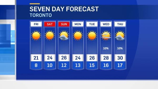
The rain and wind may last in Ontario as late as Friday, Environment Canada said.
The following areas fall under the special weather statement and rainfall warning:
- Toronto
- Halton-Peel
- York-Durham
- Hamilton
- Niagara
- Oxford-Brant
- Simcoe-Delhi-Norfolk
- Algonquin
- Grey-Bruce
- Parry Sound-Muskoka
- Burk's Falls-Bayfield Inlet
- Bancroft-Bon Echo Park
- Barrie-Orillia-Midland
- Dunnville-Caledonia-Haldimand
- Haliburton
- Waterloo-Wellington
- Elgin
- London-Middlesex
- Sarnia-Lambton
- Dufferin-Innisfil
- Peterborough-Kawartha Lakes
- Belleville-Leeds and Grenville
- Cornwall-Morrisburg
- Huron-Perth
- Kingston-Prince Edward
- Smiths Falls-Sharbot Lake
- Stirling-Tweed-South Frontenac
- Prescott and Russell
- Renfrew-Pembroke-Barry's Bay

