Toronto Hydro is continuing rolling blackouts late Tuesday night while the system tries to recover from a storm that hit the city with record-breaking rainfall.
Torontonians are being urged to conserve power as Environment Canada warned that another powerful storm system may move through the GTA overnight and into Wednesday morning.
The weather agency says intense thunderstorms could bring torrential downpours, damaging winds and large hail across much of southern Ontario.
Late Tuesday, Toronto Hydro said rotating power outages had stopped except for St. Clair Avenue south to Queen Street West, and Howland Avenue West to Parkside Drive -- although they could continue Wednesday morning.
At the peak of Monday's storm, an estimated 300,000 homes and businesses in the city were without power. According to Toronto Hydro, after the number had dipped to 20,000 by late morning, after noon approximately 50,000 people were still in the dark.
"This system is back up, but it is not in normal working condition," Toronto Hydro CEO Anthony Haines told reporters. "We are really stressing the system to meet the demands of the city as we speak."
Haines said power consumption needs to be cut by about 200 megawatts during the afternoon peak period, in order for the hydro system to handle demand.
"The system is operating beyond its operating capacity as I stand here in front of you right now," Haines said, asking residents to turn off air conditioners and non-essential lights and appliances.
Major transformer station down
Haines said the stress on the system relates to a lack of supply from a major Hydro One transformer station that's flooded.
"It's under something like 20 or 30 feet of water," he said of the station. "It puts the rest of the system on a real stress."
Ford toured Toronto’s hardest hit areas Tuesday afternoon, a day after the rainfall paralyzed the city’s roads and transit systems.
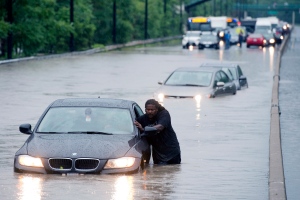
Pearson International Airport reported 126 mm of rain throughout Monday, breaking the previous single-day rainfall record for the city set back on Oct. 15, 1954, when hurricane Hazel dumped 121 mm of rain.
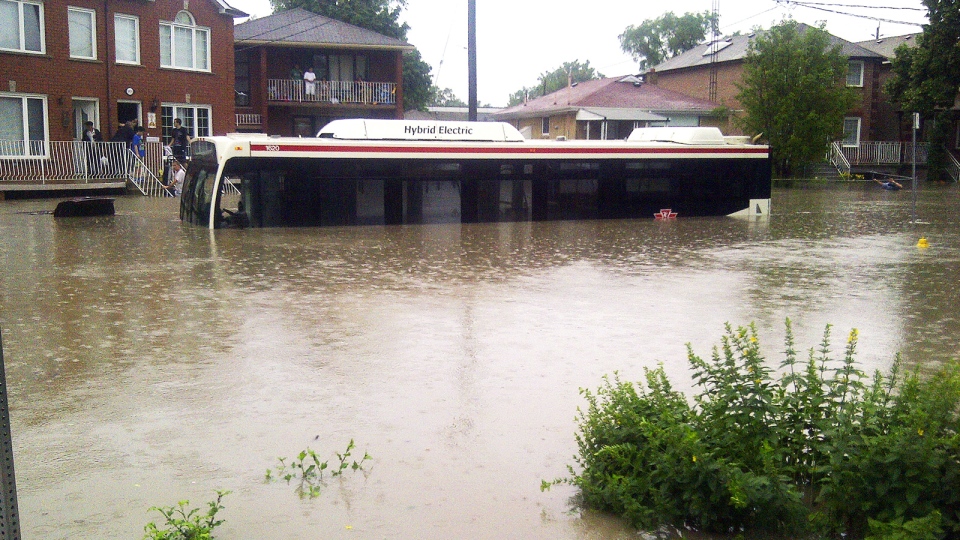
The flooding caused Toronto's subway system to come to a halt, leaving a number of people stranded during the Monday afternoon commute.
The TTC was up and running by Tuesday morning’s commute, with only a portion of the Bloor Danforth line between Kipling and Jane out of service as the track remained under water.
"I think it's been a fantastic effort by my staff. They performed a Herculean task last night to everything back," TTC CEO Andy Byford said.
The storm left some portions of the GO Transit tracks on the Lakeshore West, Milton and Richmond Hill lines completely underwater.
About 1,400 people were caught by the flooding aboard a northbound GO Transit train at Bayview and Pottery roads on Monday evening.
It took police and firefighters about seven hours to ferry everyone from the train aboard small inflatable boats.
There's room for improvement: Ford
Toronto Mayor Rob Ford said he believes the city did a great job handling Toronto’s biggest storm, but said there’s room for improvement.
"I'm glad we got through it," Ford said. "We have to learn from it to make sure we do a better job at it."
Toronto city manager Pennachetti said he believed "a lot more went right than wrong," in terms of dealing with the storm.
"Within 12 hours of the heaviest rainfall we’ve ever had in a short span of time, TTC was up and running, virtually all our roads were up and running. We only have ten road closures that we'll probably be opening later in the day," said.
He continued: "From our viewpoint it went very well, but as the mayor said there’s always room for improvement."

