
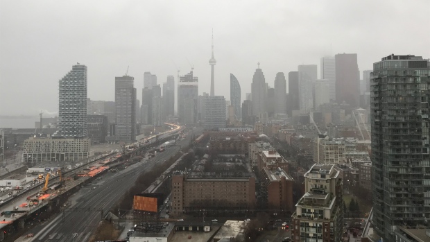
TORONTO -- A powerful storm in Toronto and the surrounding areas has resulted in flooding and power outages in parts of the region creating potentially hazardous conditions.
A rainfall warning was issued for Toronto Sunday morning, and a freezing rain warning had been issued for the rest of the Greater Toronto Area.
The Toronto and Region Conservation Authority issued a flood warning Saturday afternoon.
The agency asked residents in the region to exercise "extreme caution" around all bodies of water and avoid driving on flooded roadways in low-lying areas and underpasses.
"Due to the potential for further snowmelt caused by above freezing temperatures in the region, rivers within the GTA will be experiencing higher flows and water levels, resulting in hazardous conditions," the advisory read, adding that high waves are possible along Lake Ontario's shoreline.
"The water levels in some of TRCA’s watercourses are still rising and have yet to peak, including the Humber and Don River."
Toronto police reported hazardous conditions in the area of Bayview Avenue and Pottery Road around 4 p.m. Saturday.
Police said there is considerable flooding at the intersection, and that roads have been closed.
Drivers are being diverted to alternate routes, police said.
The flood warning is in effect until Jan. 12.
City crews will be available around-the-clock to respond to flooding calls along with members of the forestry department, which will be on standby to deal with fallen trees and branches knocked down by strong winds.
Transportation Services staff will be assisting in the city's storm response by monitoring road conditions and clearing catch basins and debris off of roadways.
Police have also reported various road closures in the region due to flood-like conditions.
Toronto Hydro reported power outages in various parts of the city due to the weather.
Hundreds of customers were affected in the Weston Road and Kipling Avenue East area and the Eglinton Avenue East and Midland Avenue East area.
The City of Mississauga also issued a flood warning for its watershed areas north and east of the city, and asked residents to stay away from watercourses.
Environment Canada said Toronto could see between 40 and 60 millimetres of rainfall by this evening.
“Since the ground is frozen, the winter rainfall warning criterion of 25 mm in 24 hours is being met,” the national weather agency said in its advisory.
“The rain may change over to freezing rain beginning later this evening as temperatures dip to near the zero degree mark. Freezing rain warnings may be needed in some areas as this event draws closer.”
Strong winds of up to 80 kilometres an hour are expected on Sunday morning.
“If visibility is reduced while driving, turn on your lights and maintain a safe following distance. Localized flooding in low-lying areas is possible,” the advisory continued.
The sustained downpour kept many people in the Greater Toronto Area off the roads.
“I had to actually had to cancel a dinner party out in Cambridge tonight because of the freezing rain and we just didn’t want to risk it,” resident Rob McArthur told CTV News Toronto Saturday.
The storm also caused organizers to postpone the inaugural Cold Toenails Refugee Run, raising money for a sponsored refugee family.
“I don’t want to give everybody catch of death pneumonia run. I want to give people a great running experience,” said organizer Aubrey Duffy with St. Matthews Anglican Church Riverdale.
The run is now scheduled to take place Feb. 1.
Environment Canada Senior Climatologist Dave Phillips said the weather today could break multiple records.
Phillips said the rainfall record for Jan. 11 is around 25 millimetres and the high temperature record is 11.7 C.


