Severe thunderstorm, 55 mm of rain set to hit parts of southern Ontario
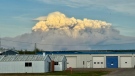
 People holding umbrellas on Sunday, July 24, 2022 THE CANADIAN PRESS/Spencer Colby
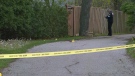
A severe thunderstorm warning has ended for parts of Ontario forecast to see heavy rainfall amounts of around 55 mm on Tuesday night.
Environment Canada issued a severe thunderstorm warning for York – Durham on Tuesday at 5:50 p.m. with downpours expected within one hour.
“This severe thunderstorm is located 5 kilometres southeast of Janetville, moving west at 10 km/h,” the weather agency said.
Not long after, just before 6:20 p.m., Environment Canada also released a warning for Peterborough – Kawartha Lakes.
“This quasi stationary cluster of severe thunderstorms is located from Lake Scugog to Bethany.”
The weather agency reminded residents in impacted parts of the province that flash floods and water pooling could take place.
Severe thunderstorm warnings are issued when a thunderstorm is likely to produce one or more of the following: large hail, damaging winds or torrential rainfall.


CTVNews.ca Top Stories

Spectacular aurora light show to be seen across Canada Friday night
A rare and severe solar storm is expected to bring spectacular displays of the northern lights, also known as aurora borealis, across much of Canada and parts of the United States on Friday night.
Town of Fort Nelson, B.C., ordered to evacuate due to wildfire
The entire town of Fort Nelson, B.C., as well as the nearby Fort Nelson First Nation, has been ordered to evacuate due to an out-of-control wildfire.
Snowbirds in Vancouver for puck-drop flyby as Canucks face Oilers
The Canadian Forces Snowbirds will be performing a flyover across downtown Vancouver at the start of tonight's Stanley Cup playoff game between the Canucks and the Edmonton Oilers.
McGill University seeks emergency injunction to dismantle pro-Palestinian encampment
McGill University has filed a request for an injunction to have the pro-Palestinian encampment removed from its campus.
Which Canadian cities have the highest and lowest grocery prices?
Where you live plays a big factor in what you pay at the grocery store. And while it's no secret the same item may have a different price depending on the store, city or province, we wanted to see just how big the differences are, and why.
Swarm of 20,000 bees gather around woman’s car west of Toronto
A swarm of roughly 20,000 bees gathered around a woman’s car in the parking lot of Burlington Centre.
Video shows naked raccoon catching B.C. family by surprise
When Marvin Henschel spotted a strange and hairless creature wandering through a front lawn in B.C.'s Lower Mainland, he could barely believe his eyes.
Barron Trump declines to serve as an RNC delegate
Former U.S. President Donald Trump's youngest son, Barron Trump, has declined to serve as a delegate at this summer’s Republican National Convention, according to a senior Trump campaign adviser and a statement from Melania Trump's office.
Out-of-control wildfire prompts evacuation alert for Fort McMurray, Saprae Creek Estates Friday night
An evacuation alert was issued for two Wood Buffalo communities Friday night, as crews battled an out-of-control wildfire near Fort McMurray.
Shopping Trends
The Shopping Trends team is independent of the journalists at CTV News. We may earn a commission when you use our links to shop. Read about us.


Montreal
-

McGill University seeks emergency injunction to dismantle pro-Palestinian encampment
McGill University has filed a request for an injunction to have the pro-Palestinian encampment removed from its campus.
-
Man charged after truck strikes and kills driver changing flat tire on side of Montreal-area highway
A 43-year-old man has been charged after a driver was struck and killed while changing a tire on the side of a Highway 15 near Montreal on Thursday.
-
Montreal comic book artist among those honoured with Canada Post stamp
Montreal graphic novelist Michel Rabagliati is among four artists Canada Post honoured with stamps that went on sale on Friday.
Ottawa
-

Ottawa's 3-container limit for curbside garbage takes effect this fall
The City of Ottawa's new three-garbage item limit for household waste will take effect on Sept. 30, with a three-month phase-in period for the limit. As of December, collection staff will only collect three garbage items from households every two weeks.
-
Tiny Home Show showcasing miniature spaces
In the midst of soaring living expenses and spiking interest rates, the dream of owning a traditional home seems to be slipping away for many residents in Ottawa.
-
Motorcycle driver in critical condition after crash in Barrhaven
Ottawa paramedics say a man in his 20s is in critical condition after a crash in Barrhaven Friday afternoon.
Northern Ontario
-
Spectacular aurora light show to be seen across Canada Friday night
A rare and severe solar storm is expected to bring spectacular displays of the northern lights, also known as aurora borealis, across much of Canada and parts of the United States on Friday night.
-
Dashcam video shows terrifying near-miss on two-lane northern Ontario highway
There were some scary moments for several people on a northern Ontario highway caught on video Thursday after a chain reaction following a truck fire.
-
Twenty defendants fined $222K for northern Ont. moose hunt violations
A large group of Canadian and U.S. defendants have been fined $178,400 plus $44,525 in surcharges for a variety of moose hunting violations in northwestern Ontario.
Kitchener
-

'A total write-off': Kitchener resident asks for thousands from city, after driving over 'faulty' manhole cover
One driver wants the City of Kitchener to cover the thousands of dollars in damage to his car after he ran over a “faulty” manhole cover.
-
Motorcyclist airlifted to hospital in critical condition after Cambridge crash
A motorcyclist was airlifted to hospital with critical injuries after a crash in Cambridge on Friday afternoon.
-
Search for new K-W hospital location narrowed down to two
We’re one step closer to finding out the new location of Kitchener-Waterloo’s newest hospital.
London
-

Lambton County teen dies in farm accident
OPP in Lambton County are investigating what is being described as a, “sudden death.” Police responded to the call at a farm on Churchill Line in Watford around 9:30 a.m.
-
Suspicious fire being investigated in London
A suspicious fire in London is under investigation by police and fire officials. According to London fire, crews knocked down the scene in an “offensive strategy.”
-
Sarnia police searching for stabbing suspect
The Sarnia Police Service has issued a warrant for a 30-year-old female in connection to a stabbing incident.
Windsor
-

New president elected for Unifor Local 444
On Friday, the union announced that James Stewart will fill the role of president, following the May 8-9 election.
-
Godfather of powerlifting celebrating half century in the sport
Jerry Marentette has broken well over 400 records through 11 different weight classes.
-
Carjacking suspects arrested: Windsor police
The Windsor police have arrested two suspects in connection with a carjacking.
Barrie
-
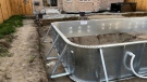
Barrie men charged with fraud in OPP investigation into pool installation scam
Two Barrie men have been charged with fraud in connection with a lengthy OPP investigation after several customers seeking pool installations were allegedly scammed out of thousands of dollars.
-
Wasaga Beach assault turns into murder investigation after victim's death
The charge against a Wasaga Beach man has been upgraded to second-degree murder after police say the victim died more than two months after an alleged assault.
-
Here's why your yard waste may have been sitting at the curb for days
A recent change in curbside collection has left some green-thumbed enthusiasts scratching their heads as bags of yard waste linger by the curb, awaiting pickup.
Winnipeg
-

'Devastating': Clear Lake watercraft ban will have an impact, business owners say
Businesses in the Clear Lake area are concerned about the future following a temporary ban on watercraft from entering the lake.
-
Roughly 250 people forced to evacuate Winnipeg apartment building deemed unsafe
Approximately 250 residents of a St. James area apartment building will have to leave their homes immediately, as the City of Winnipeg issued a vacate order over unsafe conditions.
-
Solar storm could produce highly visible northern lights in Manitoba
An unusually large solar storm could produce northern light shows that may be visible across most of Canada on Friday and Saturday.
Atlantic
-

Seven people charged following kidnapping, assault in Tobique First Nation: N.B. RCMP
RCMP say seven people have been arrested and charged in connection with a kidnapping and assault in Tobique First Nation, N.B.
-
EHS helicopters to land in new spot in Halifax
Emergency Health Services (EHS) LifeFlight helicopters will soon be landing at Canadian Forces Base Windsor Park in the Halifax's west end.
-
'Irate male' assaulted Newfoundland officers with block of cheese, police say
Police in Newfoundland say patrol officers were assaulted Thursday by a "very irate male" wielding a block of cheese.
N.L.
-

'Irate male' assaulted Newfoundland officers with block of cheese, police say
Police in Newfoundland say patrol officers were assaulted Thursday by a "very irate male" wielding a block of cheese.
-
Whooping cough outbreak declared in Newfoundland
Health officials say there is an outbreak of whooping cough in eastern Newfoundland.
-
Trucker's body found in trailer in Newfoundland after failed police search in Ontario
Ontario Provincial Police are facing tough questions about their search for a missing Newfoundland trucker whose rig was found two weeks ago in Ontario, then sent back to Newfoundland, where his body was found Monday in the trailer.
Edmonton
-
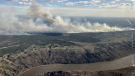
Out-of-control wildfire prompts evacuation alert for Fort McMurray, Saprae Creek Estates Friday night
An evacuation alert was issued for two Wood Buffalo communities Friday night, as crews battled an out-of-control wildfire near Fort McMurray.
-
'Violent, despicable and unbelievable': Family of murdered 7-year-old speak at David Moss sentencing Friday
David Moss, the man who murdered seven-year-old Bella Rose Desrosiers, broke down in court Friday as the girl's family spoke about the toll her death has taken on them.
-
Man in hospital after crashing into light post on Anthony Henday Drive Friday night
A man is in hospital in serious condition after he crashed into a street light on Anthony Henday Drive in southwest Edmonton Friday night.
Calgary
-

'We have laws': Premier Smith says police action justified in Calgary
The actions, including the decision to use non-lethal force, to disperse pro-Palestinian protesters from the University of Calgary campus were justified, Alberta Premier Danielle Smith said Friday.
-
City of Chestermere inspection reveals ‘irregular, improper and improvident’ financial management: province
A third-party examination of the City of Chestermere revealed “significant gaps” in the financial management, the province said Friday.
-
Calgary says goodbye to Eau Claire Market as expropriated residents fight on
These are the final hours for Eau Claire Market, and the final days for residents of a nearby townhouse complex.
Regina
-

Healthcare divide between Alberta, Sask. persists post-pandemic: Doctor
Easier access to certain types of medical care has become more difficult for some residents in southwestern Saskatchewan, according to a Swift Current doctor.
-
Sask. teachers set to vote on renewed sanctions mandate
Next week, teachers in Saskatchewan will vote on a renewed mandate that would implement sanctions beyond the current school year.
-
Regina police charge 3, seize drugs, ammunition after 'months long investigation'
Regina police say three people have been charged after they seized more than 1,100 grams of a substance believed to be cocaine along with suspected meth and ammunition following a “months long investigation.”
Saskatoon
-

Sask. teachers set to vote on renewed sanctions mandate
Next week, teachers in Saskatchewan will vote on a renewed mandate that would implement sanctions beyond the current school year.
-
Dump truck heavily damaged after crash on Circle Drive North
A dump truck was heavily damaged following a crash Friday afternoon on Circle Drive North.
-
Nutrien CEO wants fully automated or tele-remote operations in all 6 mines
Improved mine automation helped fertilizer giant Nutrien Ltd. increase potash production in the first quarter amid strong demand for its products, the company's chief executive said.
Vancouver
-
Town of Fort Nelson, B.C., ordered to evacuate due to wildfire
The entire town of Fort Nelson, B.C., as well as the nearby Fort Nelson First Nation, has been ordered to evacuate due to an out-of-control wildfire.
-
'State or state-sponsored actor' believed to be behind B.C. government hacks
The head of British Columbia’s civil service has revealed that a “state or state-sponsored actor” is behind multiple cyber-security incidents against provincial government networks.
-
B.C. woman's lifelong birthday wish comes true after unexpected message from elementary school classmate
Karen Harrison made the same birthday wish every year from age six to age 50. When she had given up hope, it finally came true.
Vancouver Island
-

'State or state-sponsored actor' believed to be behind B.C. government hacks
The head of British Columbia’s civil service has revealed that a “state or state-sponsored actor” is behind multiple cyber-security incidents against provincial government networks.
-
B.C. woman's lifelong birthday wish comes true after unexpected message from elementary school classmate
Karen Harrison made the same birthday wish every year from age six to age 50. When she had given up hope, it finally came true.
-
Police launch assault investigation at UVic protest encampment
Police in Saanich, B.C., say an assault investigation is underway following two alleged incidents at a pro-Palestinian protest encampment on the grounds of the University of Victoria.


