'Be prepared': Toronto to flip between summer and winter weather
A rainfall warning has ended in Toronto, but that doesn’t mean the soggy spree is over just yet.
“The rain has tapered off but the system hasn't ended because this is a big system that's covering Ontario, all the way to Atlantic Canada,” Environment Canada Meteorologist Gerald Cheng told CP24.
In just the last 24 hours, an estimated 42 millimetres of rain has fallen in the Toronto-area, recorded at Pearson International Airport.
Environment Canada issued a weather advisory late Thursday evening for Toronto, Peel, Halton, York and Durham regions, which ended late Friday morning, while northwesterly winds are set to peak tonight with gusts of 70 to 80 km/h.
Winds will ease by Saturday morning as the low pressure system departs.
“Well, spring is really a transition season and we are trying to exit out of winter, but we're not quite there yet ... We are flipping back and forth between summer weather, and winter weather, and we have to be prepared for that,” Cheng said.
In terms of temperature, a high of 12 C is expected in Toronto Friday, going down to a low of 4 C overnight.
There’s a 40 per cent chance of showers on Saturday, with partial sunshine and a high of 10 C expected. A high of 15 C is expected on Sunday with a 30 per cent chance of showers.
Next week is expected to start off warm and sunny, with highs of 16 C and 17 C Monday and Tuesday. More rain could be in store Wednesday and Thursday, but temperatures are expected to remain in the high teens.


CTVNews.ca Top Stories

Air Canada walks back new seat selection policy change after backlash
Air Canada has paused a new seat selection fee for travellers booked on the lowest fares just days after implementing it.
Province boots mayor and council in small northern Ont. town out of office
An ongoing municipal strike, court battles and revolt by half of council has prompted the province to oust the mayor and council in Black River-Matheson.
3 law officers serving warrant are killed, 5 wounded in shootout at North Carolina home, police say
Three officers on a U.S. Marshals Task Force serving a warrant for a felon wanted for possessing a firearm were killed and five other officers were wounded in a shootout Monday at a North Carolina home, police said.
'Shocked and concerned': Calgary principal charged with possession of child pornography
A Calgary elementary school principal has been charged with possession of child pornography, authorities announced Monday.
Health authority confirms cockroaches at B.C. hospital, insists they 'do not bite'
The Vancouver Island Health Authority is downplaying what staff describe as a cockroach infestation in a medical unit of Saanich Peninsula Hospital.
Toronto police arrest 12 people, lay 102 charges in major credit card fraud scheme
Toronto police say 12 people are facing a combined 102 charges in connection with an investigation into a major credit fraud scheme.
Winner of US$1.3 billion Powerball jackpot is an immigrant from Laos who has cancer
One of the winners of a historic US$1.3 billion Powerball jackpot last month is an immigrant from Laos who has had cancer for eight years and had his latest chemotherapy treatment last week.
Britney and Jamie Spears settlement avoids long, potentially ugly and revealing trial
Britney Spears and her father Jamie Spears will avoid what could have been a long, ugly and revealing trial with a settlement of the lingering issues in the court conservatorship that controlled her life and financial decisions for nearly 14 years.
WATCH
WATCH 'Double whammy': What happens if you don't file your taxes by the deadline
The clock is ticking ahead of the deadline to file a 2023 income tax return. A personal finance expert explains why you should get them done -- even if you owe more than you can pay.
Shopping Trends
The Shopping Trends team is independent of the journalists at CTV News. We may earn a commission when you use our links to shop. Read about us.


Montreal
-
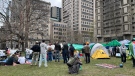
McGill University says pro-Palestinian demonstrators 'refuse' to collaborate, encampment violates policies
McGill University says the growing encampment on its lower field in solidarity with Palestinians in Gaza violates its policies.
-
Quebec police officer anonymously donates kidney, changes schoolteacher's life
A police officer on Montreal's South Shore anonymously donated a kidney that wound up drastically changing the life of a schoolteacher living on dialysis.
-
Q&A: Quebec minister on the $603 million plan to protect the French language
Quebec Minister Responsible for the French Language Jean-François Roberge spoke to CTV News Montreal anchor Maya Johnson about the government's plan to spend $603 million to protect the French language
Ottawa
-

Treasury Board 'committed to hybrid work' after reports of mandated change coming in fall
The Treasury Board of Canada will only say it is “committed to hybrid work,” as reports suggest federal workers may be required to spend more time in the office.
-
One woman's story about the damage fraudulent links can do
An Ottawa woman says she believes clicking on a fraudulent link led to her entire bank account being compromised, leaving her out thousands of dollars.
-
Ottawa Catholic School Board building 'broader' technology policy as province announces cellphone crackdown
As the Ontario government gets set to ban cellphones in school starting in September, the Ottawa Catholic School Board is poised to develop its own local policy encompassing 'broader technological considerations.'
Northern Ontario
-
Province boots mayor and council in small northern Ont. town out of office
An ongoing municipal strike, court battles and revolt by half of council has prompted the province to oust the mayor and council in Black River-Matheson.
-
Former child protection worker in northern Ont. charged with sexual assault
Police in Greater Sudbury have charged a 57-year-old Sudbury suspect with sexual assault in a case that dates back 25 years.
-
Human skeletal remains found in Chelmsford area of Greater Sudbury, police say
A gruesome discovery was made in a remote wooded area of Greater Sudbury on Sunday night, Sudbury police say.
Kitchener
-
Man sentenced in 'shocking, unprovoked attack on a stranger' at Cambridge grocery store
A man who stabbed an employee at a Cambridge grocery store in 2022 has been sentenced to three years behind bars.
-
Waterloo exploring potential MZO for new affordable housing project
The City of Waterloo is moving forward with a plan to try and rezone 25 acres of city-owned land near RIM Park to allow for affordable and attainable housing.
-
Ont. government bans cellphones in the classroom
Ontario Premier Doug Ford says the province's latest attempts to limit cellphone use in classrooms are designed to help students focus on learning.
London
-

Stunt driving charge laid after police clock driver travelling nearly 200km/h
An individual from Cambridge was charged while speeding on Highway 6 in South Bruce Peninsula.
-
Free parking promo in core business districts hits speed bump at committee
It will be up to city council to decide if a one-hour free parking promotion returns to the core.
-
Multiple ceremonies held in London, Ont. area to mark ground-breaking of new schools, childcare centres
Multiple ceremonies were held Monday to mark the beginning of construction of several new schools and childcare centres across the London region.
Windsor
-
Motorcycle driver dead after crash with car on Dougall Avenue
A 19-year-old motorcycle driver has died after being struck by a car on Sunday evening. Around 8:30 p.m., police responded to the crash in the southbound lanes of Dougall Avenue near the E.C. Row Expressway.
-
Sinkhole closes downtown Windsor intersection
A section of downtown Windsor has been closed to all vehicle and pedestrian traffic after a sinkhole opened up in the middle of an intersection.
-
Sentencing delayed for Windsor denturist convicted of sex offences
Sentencing has been delayed for a Windsor denturist convicted of sex offences.
Barrie
-

Police investigate $90,000 worth of stolen golf carts
Police continue to investigate a golf cart theft in the Township of Oro-Medonte, as eleven carts were stolen from Settlers' Ghost Golf Club just over a week ago.
-
Full road closure on County Road 27
County Road 27 is closed due to an ongoing collision investigation.
-
One person killed in Blue Mountains crash
OPP is investigating a single vehicle crash in The Blue Mountains that claimed the life of one person.
Winnipeg
-
Winnipeg trial of man accused of killing four women starts with bid to toss jury
The trial of a Winnipeg man accused of killing four women began this morning with a preliminary matter before the jury is called in next week.
-
Winnipeg working on new way to fill potholes, with hopes of fewer repairs needed
There may be hope for Winnipeggers as they try to dodge numerous potholes on their daily commute. The city is testing out a new product known as Road Soup, which would be used to help fill the craters during the early spring.
-
'We’re almost stuck': Outrage in La Broquerie over property tax hike, road conditions
Some La Broquerie residents are outraged over a hefty property tax hike coming later this year.
Atlantic
-

Third youth charged with second-degree murder in death of 16-year-old: Halifax police
Police have charged a third youth in connection with the death of a teenager in Halifax last week.
-
Bedford man charged with stunting after vehicle clocked at 248 km/h: N.S. RCMP
A Bedford, N.S., man has been charged with stunting after the RCMP says he was caught driving more than 138 km/h over the posted speed limit.
-
Burn ban not stopping some Nova Scotians from sparking up backyard blazes
Fire pit activity has been held to a minimum lately, but rain on Monday provided some relief from the mild and windy conditions of last week.
N.L.
-

'I feel honoured to say I was his friend': Wayne Gretzky remembers Bob Cole
Tributes continue to pour in for Bob Cole as his family has confirmed a funeral will be held for the legendary broadcaster Friday in St. John's, N.L.
-
Voice of 'Hockey Night in Canada' Bob Cole never considered moving out of St. John's
Legendary sportscaster Bob Cole was a Newfoundlander through and through, and his daughter says his connection to the province was 'everything' to him.
-
Cenovus fined $2.5 million for biggest oil spill in Newfoundland and Labrador history
Cenovus Energy has been ordered to pay a $2.5-million fine for its role in the largest offshore oil spill ever recorded in Newfoundland and Labrador.
Edmonton
-
'There have been deaths on that property': City plans to demolish former Dwayne's Home building
The city could be on the hook for the bill to demolish a problem building in the heart of Edmonton.
-
Drinks outside on Rice Howard Way? Council to review proposal next month
Edmonton could have a downtown outdoor entertainment district as soon as June 1.
-
Alberta Municipalities say proposed provincial bill will create chill effect
The organization representing Alberta's cities, towns and villages says a bill that would grant the province sweeping new powers over local governments is creating an atmosphere of fear.
Calgary
-
'Shocked and concerned': Calgary principal charged with possession of child pornography
A Calgary elementary school principal has been charged with possession of child pornography, authorities announced Monday.
-
Alberta government announces 'master plan' for railway development
The Alberta government has laid out the path ahead for an ambitious passenger railway system it says 'has incredible potential' for the province.
-
Here's how Canada's capital gains tax increase will affect Albertans with vacation properties
A new capital gains tax increase, aimed at Canada’s highest earners, is causing frustration for some Albertans with secondary homes or cottages, according to a real estate broker.
Regina
-

Sask. NDP criticized after email shows party attempt to secure sponsorship from previously criticized lobbying firm
The Saskatchewan NDP's recent criticism of political lobbyists has backfired. During question period on Monday, the government revealed an NDP email in which the party requested sponsorship from a lobby firm that it had previously criticized.
-
CRA to audit Sask. for not paying carbon levies on home heating
The Canada Revenue Agency (CRA) is going to audit Saskatchewan for not paying carbon levies on home heating, Premier Scott Moe said Monday.
-
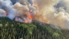
Saskatchewan carrying out prescribed burns as 2024 fire season begins
With fire bans currently in effect, residents may be concerned to see smoke coming from rural areas across Saskatchewan. However, prescribed burns are being carried out to help keep many prairie regions healthy.
Saskatoon
-

Sask. school divisions struggling to 'maintain a status quo' amid years of underfunding
Sask. school divisions struggling to ‘maintain a status quo' amid years of underfunding
-
Sask. First Nation searches for suspected arsonist as grass fire threatens community
Members of Red Pheasant Cree Nation are looking for help finding someone who they believe started a grassfire that’s blanketed the community in smoke and threatened its infrastructure.
-
Cash is critical in keeping small businesses afloat, Saskatoon pub owner says
A Saskatoon business is encouraging customers to pay with cash instead of a credit card to help fight inflation.
Vancouver
-

Arrest made in fatal White Rock stabbing
Homicide investigators have arrested a man for the fatal stabbing of Kulwinder Singh Sohi in White Rock.
-
Pierre Poilievre weighs in on BC NDP plan to recriminalize public drug use
B.C.’s plan to reverse course on a major part of its decriminalization plan has triggered swift and sweeping reaction.
-
Richmond residents call out city councillors over conduct
Two Richmond residents claim members of city council stepped over the line during the tense meetings regarding the establishment of a supervised drug consumption site.
Vancouver Island
-

Green Party deputy leader released pending appeal of jail sentence for Fairy Creek protests
British Columbia's highest court has ordered the Green Party of Canada's deputy leader to be released from custody pending her appeal of a 60-day jail sentence for her role in old-growth logging protests on Vancouver Island.
-
Health authority confirms cockroaches at B.C. hospital, insists they 'do not bite'
The Vancouver Island Health Authority is downplaying what staff describe as a cockroach infestation in a medical unit of Saanich Peninsula Hospital.
-
London Drugs stores remain closed Monday after 'cybersecurity incident'
Dozens of London Drugs stores across Western Canada remained closed Monday following what the company described as a "cybersecurity incident" over the weekend.


