GTA and much of southern Ontario hit by messy mix of rain, snow and freezing rain
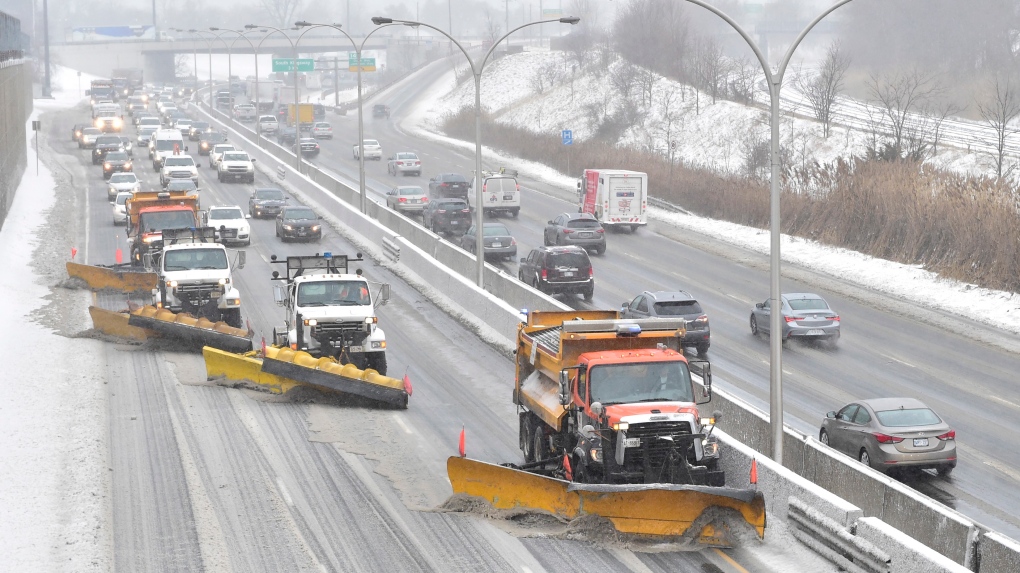 In this file photo, A line of snow plows clears the Gardiner Expressway in Toronto on Tuesday, Feb.12, 2019 after a winter storm hit the region. THE CANADIAN PRESS/Frank Gunn
The Greater Toronto Area and much of southern Ontario are being hit with a mix of messy winter weather on the heels of a spring-like reprieve.
A snowfall warning is currently in effect from Environment Canada for the City of Toronto and many surrounding areas. The agency also issued a special weather statement due to the rain fall.
According to the agency, the city could see as much as 15 to 25 mm of rain from Wednesday evening through Thursday evening, followed by snowfall accumulation of 10 to 20 cm from Thursday afternoon through Friday morning.
“A low pressure system is expected to track northeast across Lake Erie and Lake Ontario Thursday night which will bring a messy mix of wintry precipitation to southern Ontario,” Environment Canada wrote in its warning.
“Rain is expected to transition to snow this morning or this afternoon.”
Snowfall warnings are also in effect for York, Durham and Peel regions, as well as most areas of southern Ontario from Cornwall to Windsor.
Environment Canada noted that precipitation timing and amounts may change, as the exact track of the system remains uncertain.
“Be prepared to adjust your driving with changing road conditions,” the agency warned. “Rapidly accumulating snow could make travel difficult over some locations. Visibility may be suddenly reduced at times in heavy snow. Surfaces such as highways, roads, walkways and parking lots may become difficult to navigate due to accumulating snow.”
CP24 Meteorologist Chris Potter said commuters should be ready to go from “spring to winter in just a matter of hours tomorrow.”
“Spring-like conditions here at least for now through the overnight and early tomorrow morning, and then winter makes a grand reappearance as we cool down,” Potter said.
He said both morning and evening commutes are likely to be impacted by the messy weather.
“The first one in the morning obviously will be impacted by the potential for ponding, cooling, hydroplaning, slightly reduced visibility and rainfall,” Potter said. “But then by the afternoon and into the evening, icy, slippery roads are expected because obviously we go from warm to cold.
“So any lingering water, standing water might freeze up and then of course the added un-benefit, if you will, of freezing rain and ice pellets across the lower Great Lakes, including the GTA.”
After weeks of frigid temperatures, the city saw an unseasonable high of 9 C Wednesday.
A high of 6 C is expected Thursday morning, but the temperature is expected to drop into the afternoon, going down to a low of -11 C.
In a news release Wednesday, the City of Toronto said “winter crews and equipment are ready to respond” to the messy weather.
“The city has a comprehensive snow and ice response plan with operations focused on the safety and movement of residents and emergency vehicles with the salting and plowing of roads, sidewalks and bike lanes,” the city said in its release.
The city said it would provide an update on its efforts Thursday and advised drivers to use extra caution on the roads.
The City of Toronto also issued a extreme cold weather alert on Thursday morning, saying its warming centres will be open to the public until further notice.
CTVNews.ca Top Stories

Canadian government announces new border security plan amid Donald Trump tariff threats
The federal government has laid out a five-pillared approach to boosting border security, though it doesn't include specifics about where and how the $1.3-billion funding package earmarked in the fall economic statement will be allocated.
Fall sitting bookended by Liberal byelection losses ends with Trudeau government in tumult
The House of Commons adjourned on Tuesday, bringing an end to an unstable fall sitting that has been bookended by Liberal byelection losses. The conclusion of the fall sitting comes as Prime Minister Justin Trudeau's minority government is in turmoil.
Police chief says motive for Wisconsin school shooting was a 'combination of factors'
Investigators on Tuesday are focused on trying to determine a motive in a Wisconsin school shooting that left a teacher and a student dead and two other children in critical condition.
14 dead and hundreds injured in magnitude 7.3 quake in Vanuatu. Some people are trapped in rubble
A magnitude 7.3 earthquake that struck off Vanuatu killed at least 14 people, injured hundreds more and caused widespread damage across the South Pacific island nation, rescuers and officials said early Wednesday. Rescuers worked through the night trying to reach some people yelling under the rubble.
Prosecutors charge suspect with killing UnitedHealthcare CEO as an act of terrorism
The man accused of killing UnitedHealthcare's CEO has been charged with murder as an act of terrorism, prosecutors said Tuesday as they worked to bring him to a New York court from from a Pennsylvania jail.
'She will not be missed': Trump on Freeland's departure from cabinet
As Canadians watched a day of considerable political turmoil for Prime Minister Justin Trudeau and his government given the sudden departure of Chrystia Freeland on Monday, it appears that U.S. president-elect Donald Trump was also watching it unfold.
The world's busiest flight routes for 2024 revealed
If you think planes have got fuller and the skies busier over the past year, you’d be right — especially if you live in either Hong Kong or Taipei.
NASA's 2 stuck astronauts face more time in space with return delayed until at least late March
NASA's two stuck astronauts just got their space mission extended again. That means they won’t be back on Earth until spring, 10 months after rocketing into orbit on Boeing’s Starliner capsule.
Sex-ed group deemed 'inappropriate' by Tory government returns to N.B. schools
A sexual-education group whose presentations were deemed "clearly inappropriate" by the previous New Brunswick Progressive Conservative government has been cleared to return to the province's schools.


