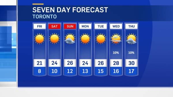
A late-season winter storm could bury southern Ontario in more than 15 centimetres of snow on Wednesday.
Environment Canada is warning of heavy snowfall, strong winds and poor visibility during the snow storm.
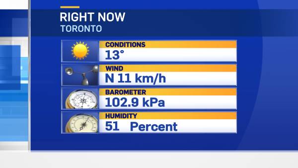
The weather agency warns the public not to be fooled by Tuesday's mild temperatures: Winter is not over.
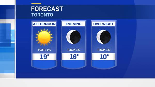
The high in Toronto will reach 8 C, before the weather makes a turn overnight. GTA residents will wake up to a snowy, sub-zero winter wonderland.
As a low pressure system travels past the Great Lakes, snow will be generated and will blow in from the water.
Snowfall accumulation will depend on the exact path of the storm, but Environment Canada predicts it will be in the 5- to 15-centimetre range.
The public is advised to monitor future forecasts and warnings, and be cautious when driving due to poor visibility.
The following areas are expected to be hardest hit by the storm:
- Brockville-Leeds and Grenville
- Cornwall-Morrisburg
- Dunnville-Caledonia-Haldimand
- Elgin
- Kingston-Prince Edward
- Niagara
- Simcoe-Delhi-Norfolk
- Stirling-Tweed-South Frontenac
- Windsor-Essex-Chatham-Kent