BREAKING
A severe thunderstorm warning has ended for parts of Ontario forecast to see heavy rainfall amounts of around 55 mm on Tuesday night.
Environment Canada issued a severe thunderstorm warning for York – Durham on Tuesday at 5:50 p.m. with downpours expected within one hour.
“This severe thunderstorm is located 5 kilometres southeast of Janetville, moving west at 10 km/h,” the weather agency said.
Not long after, just before 6:20 p.m., Environment Canada also released a warning for Peterborough – Kawartha Lakes.
“This quasi stationary cluster of severe thunderstorms is located from Lake Scugog to Bethany.”
The weather agency reminded residents in impacted parts of the province that flash floods and water pooling could take place.
Severe thunderstorm warnings are issued when a thunderstorm is likely to produce one or more of the following: large hail, damaging winds or torrential rainfall.

In an effort to level the playing field for young people, in the 2024 federal budget, the government is targeting Canada's highest earners with new taxes in order to help offset billions in new spending to enhance the country's housing supply and social supports.
From plans to boost new housing stock, encourage small businesses, and increase taxes on Canada’s top-earners, CTVNews.ca has sifted through the 416-page budget to find out what will make the biggest difference to your pocketbook.
With a variety of fiscal and policy measures announced in the federal budget, winners include small businesses and fintech companies while losers include the tobacco industry and Canadian pension funds.
Five thousand public service jobs will be cut over the next four years, while underused federal office buildings, Canada Post properties and the National Defence Medical Centre in Ottawa could be turned into new housing units, as the federal government looks to find billions of dollars in savings and boost the country's housing portfolio.
The Liberals are proposing new charges for the use of violence while stealing a vehicle and for links to organized crime, as well as laundering money for the benefit of a criminal organization.
The federal government is providing up to $5 billion in loan guarantees to help Indigenous communities invest in natural resource and energy products. But when it comes to a promise to close what advocates say is a sprawling Indigenous infrastructure gap, Ottawa is short more than $420 billion.
Police say that arrests have been made in connection with a $20-million gold heist at Toronto Pearson International Airport one year ago.
Shoppers Drug Mart is facing a proposed class-action lawsuit by current and former franchise owners at the retail chain who allege parent company Loblaw engaged in corporate practices that placed them in an “irredeemable conflict of interest” and put patient care at risk.
Lululemon says it is combining function and fashion in its first-ever summer kit for Canada's Olympians and Paralympians.
The Shopping Trends team is independent of the journalists at CTV News. We may earn a commission when you use our links to shop. Read about us.

A Quebec Superior Court judge has authorized a class-action lawsuit against 16 pharmaceutical companies that are alleged to have misled consumers about the efficacy and dangers of opioid medications.
Despite sharing the Parti Quebecois (PQ)'s desire to make Quebec a country, Quebec Solidaire (QS) parliamentary leader Gabriel Nadeau-Dubois has roundly criticized PQ leader Paul St-Pierre Plamondon's speech, calling it 'conservative.'
An international competition is hoping to gather new and interesting ways to recycle Montreal's Olympic Stadium roof, which is set to be dismantled this summer.

Five thousand public service jobs will be cut over the next four years, while underused federal office buildings, Canada Post properties and the National Defence Medical Centre in Ottawa could be turned into new housing units, as the federal government looks to find billions of dollars in savings and boost the country's housing portfolio.
In an effort to level the playing field for young people, in the 2024 federal budget, the government is targeting Canada's highest earners with new taxes in order to help offset billions in new spending to enhance the country's housing supply and social supports.
The Ottawa Police Service will receive $50 million in new federal funding over the next five years to "enhance security" around the Parliamentary Precinct.

Rescue crews are searching for a man reported missing on the weekend after the vehicle he was driving was pulled into a creek near the Quebec border in northern Ontario.
The YMCA of Sault Ste. Marie is selling its building and ceasing operations in May.
City officials in Sudbury say construction season started early this year thanks to the warm weather this spring.

Cambridge resident Samantha Falkiner explains why something felt "off" about the men who approached her and her neighbours on Friday.
Waterloo Regional Police Services has released the estimated total cost for the St. Patrick’s Day weekend in the city of Waterloo.
Brantford police are investigating a series of personal thefts and are seeking information from the public to identify the people responsible.

A two-vehicle crash between a pickup truck and a transport truck on Highway 401 south of London, Ont. has resulted in one fatality Tuesday afternoon, with police warning motorists to expect delays in the area.
A driver from London will have to find alternative transportation after an OPP officer clocked them travelling nearly 200 km/h on Highway 401 over the weekend.
A number of students have been displaced after a house fire in east London near Fanshawe College. Crews were called to the scene on Prosperity Court late Monday night.

A group of landlords contesting the city’s new residential rental licensing bylaw is appealing a recent court decision.
In an effort to level the playing field for young people, in the 2024 federal budget, the government is targeting Canada's highest earners with new taxes in order to help offset billions in new spending to enhance the country's housing supply and social supports.
The ‘faint hope’ hearing of Ali Al-Shammari, 38, continued Tuesday in Superior court.

Two new shows are coming to Casino Rama's Entertainment Centre for fans of country music and 80s rock.
Fire officials say a lithium-ion battery inside a vacuum cleaner sparked a fire at an apartment complex Sunday afternoon in Gravenhurst.
Owen Sound dog owners could face a pretty penny for not leashing their dogs or picking up after them.

Three teenagers were arrested in connection with a pair of alleged hazing incidents on a Manitoba hockey team, police say.
In an effort to level the playing field for young people, in the 2024 federal budget, the government is targeting Canada's highest earners with new taxes in order to help offset billions in new spending to enhance the country's housing supply and social supports.
One Winnipeg sports memorabilia shop has been the target of multiple break-ins and is now looking to recover some stolen property.

The Nova Scotia RCMP says four people have been charged following a man’s homicide two years ago.
A portion of Barrington Street has reopened after a three-vehicle crash Tuesday morning.
An inmate who escaped from Dorchester Penitentiary in Dorchester, N.B., on Saturday evening has a long history of violent crimes and a history of escaping custody.

A Celebrity Apex cruise to the Caribbean this month turned into a rocking Newfoundland kitchen party when hundreds of people from Canada's easternmost province happened to be booked on the same ship.
A pricing agreement has been reached between crab fishers and seafood processors that will allow for Newfoundland and Labrador's annual crab fishery to get started.
Longliners across Newfoundland and Labrador are tied up once again, as a new protest by the province's fish harvesters threatens to derail the crab fishery for a second straight year.

A pipeline was involved in a wildfire in western Alberta on Tuesday, Yellowhead County says.
The Edmonton Oilers are bringing back watch parties inside and outside Rogers Place when the Stanley Cup Playoffs begin in the coming days.
Three people have been charged after police recovered nearly half a million dollars worth of stolen property.
A Crown prosecutor making the case against three men charged with mischief at the border blockade at Coutts, Alta., told jurors Tuesday they don’t have to determine the accused were kingpins of the protest in order find them guilty.
In an effort to level the playing field for young people, in the 2024 federal budget, the government is targeting Canada's highest earners with new taxes in order to help offset billions in new spending to enhance the country's housing supply and social supports.
Calgary police say the driver of a BMW was given a summons for a mandatory court appearance after being caught travelling more than double the speed limit.

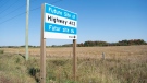
Winter weather seemed to be in the rear view mirror for Saskatchewan the past couple weeks, but now Environment and Climate Change Canada (ECCC) is forecasting as much as 30 centimetres of snow for some parts of the province.
Saskatchewan NDP Leader Carla Beck highlighted concerns around mental health, addictions and infrastructure as she addressed the Saskatchewan Urban Municipalities Association (SUMA) conference.
In an effort to level the playing field for young people, in the 2024 federal budget, the government is targeting Canada's highest earners with new taxes in order to help offset billions in new spending to enhance the country's housing supply and social supports.

The founders of a Saskatoon real estate investment company that left investors with millions of dollars in losses have reached a settlement with Saskatchewan’s financial and consumer watchdog.
Two men accused of beating and tying up a mentally ill man on a Saskatchewan farm have pleaded guilty to assault causing bodily harm.
Winter weather seemed to be in the rear view mirror for Saskatchewan the past couple weeks, but now Environment and Climate Change Canada (ECCC) is forecasting as much as 30 centimetres of snow for some parts of the province.

British Columbia's highest court has upheld a manslaughter conviction against a Vancouver man who shoved a senior outside a busy Costco store, rejecting his argument that the trial judge failed to consider how his claustrophobia and fear of crowds led to the fatal altercation.
In an effort to level the playing field for young people, in the 2024 federal budget, the government is targeting Canada's highest earners with new taxes in order to help offset billions in new spending to enhance the country's housing supply and social supports.
A man who was shot in the face in downtown Vancouver earlier this month was an innocent bystander, according to an update from authorities.
British Columbia's highest court has upheld a manslaughter conviction against a Vancouver man who shoved a senior outside a busy Costco store, rejecting his argument that the trial judge failed to consider how his claustrophobia and fear of crowds led to the fatal altercation.
The Department of Fisheries says planning for a new attempt to rescue an orca calf trapped in a Vancouver Island lagoon will be finalized in the next few days but no date has been set.
The family of a Victoria, B.C., woman who was seriously injured in an accident in Thailand is pleading for help as medical bills pile up.