As Hurricane Milton makes landfall, more than 1.6 million customers are left without power in Florida
EDITOR'S NOTE: This is CTVNews.ca's Hurricane Milton coverage for Wednesday, Oct. 9. For live updates on Thursday, click here.
Hurricane Milton has made landfall in Florida Wednesday night.
Follow along for live updates throughout the day.
10:40 p.m. EDT: More than 1.6 million Florida customers without power
More than 1.6 million power customers in Florida were left in the dark Wednesday night as Hurricane Milton battered the state with tornadoes, flooding and strong winds.
Counties along the western coast of the peninsula were hardest hit, particularly in the central portion of the state. Nearly all of the roughly 9,600 Peace River Electric Coop customers in Hardee County were without power shortly after 10 p.m., according to the website PowerOutage.us.
Outage numbers were climbing throughout the evening but still have not yet reached the totals seen when Hurricane Ian hit Florida in 2022. That storm affected more than 4.45 million power customers over several days in four states, according to PowerOutage.us, impacting more than 9.6 million people in all.
By Rebecca Boone from The Associated Press
10:35 p.m. EDT: Flash flood warning for Fla. cities
The U.S. National Weather Service for Tampa Bay announced on social media that Tampa, St. Petersburg and Clearwater will be under a flash food warning until at least 2:45 a.m. EDT.
10:10 p.m. EDT: More than 125 homes destroyed before landfall
More than 125 homes were destroyed before Hurricane Milton even made landfall, many of them mobile homes in communities for senior citizens, according to Kevin Guthrie, the director of the Florida Division of Emergency Management.
10 p.m. EDT: Milton downgrades to Category 2
Hurricane Milton has reached maximum sustained winds of 110 m.p.h. (175 km/h), downgrading it to a Category 2 hurricane, according to the U.S. National Hurricane Center.
Despite it slowing down, a flash flood emergency is still in effect for the Tampa Bay area as the storm continues to move inland.
9:55 p.m. EDT: Winds top 100 m.p.h. (160 km/h)
Wind gusts as high as 102 miles per hour (165 km/h) were reported at a Tampa Bay-area fishing pier as Hurricane Milton pummeled Florida Wednesday night, the National Hurricane Center said.
The tropical cyclone was bringing life-threatening storm surge and flash flooding along with the extreme winds, the hurricane center said.
The weather said the hurricane sustained winds of 115 m.p.h. (185 km/h) as the center of the storm passed near the town of Sarasota, making the storm still a Category 3.
By Rebecca Boon from The Associated Press
9:45 p.m. EDT: Flash flood emergency issued for Tampa
A flash flood emergency has been issued for Tampa, according to the U.S. National Weather Service.
9:42 p.m. EDT: Nearly 1.3 million without power
1,280,000 homes and businesses are without power in Florida due to Hurricane Milton, according to PowerOutage.us.
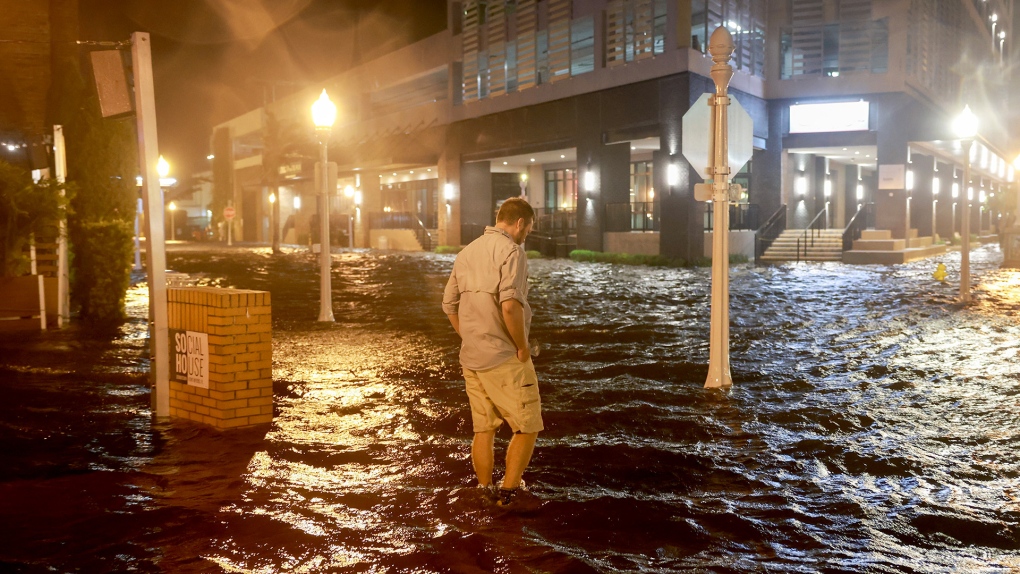 FORT MYERS BEACH, FLORIDA - OCTOBER 09: Brandon Marlow walks through surge waters flooding the street after Hurricane Milton came ashore in the Sarasota area on October 09, 2024, in Fort Myers, Florida. People are waiting to assess the damage after the Cat 3 hurricane came ashore. (Photo by Joe Raedle/Getty Images)
9:38 p.m. EDT: Search and rescue efforts underway in Florida, officials say
Officials say search and rescue efforts are underway in Florida after dangerous tornadoes ripped through the region.
About 125 homes were destroyed before the hurricane made landfall, many of them mobile homes in communities for senior citizens, said Kevin Guthrie, the director of Florida’s Division of Emergency Management.
St. Lucie County Sheriff Keith Pearson posted a video to Facebook showing a 10,000 square-foot (930 square-metres) iron building that had been twisted into a crumpled heap by a tornado. The structure was where the sheriff’s office kept its patrol cars, but luckily no one was inside when it fell, Pearson said.
By Rebecca Boone from The Associated Press
9 p.m. EDT: More than 800,000 Florida households without power
With Hurricane Milton officially making landfall in Florida, more than 800,000 households are without power, according to PowerOutage.us. That is an increase of nearly 300,000 from less than an hour ago.

8:40 p.m. EDT: DeSantis tells Florida residents to shelter
As Hurricane Milton made landfall in Florida, Gov. Ron DeSantis told residents in a post on social media that search and rescue efforts would be underway as soon as weather conditions improved.
8:30 p.m. EDT: Hurricane Milton makes landfall
The “extremely dangerous Category 3 hurricane” has made landfall near Siesta Key, Fla., according to the U.S. National Hurricane Center.
Flash flooding, extreme winds and life-threatening storm surges have been reported across the central Florida peninsula.
The storm had maximum sustained winds of 120 m.p.h. (205 km/h) upon landing at 8:30 p.m., the centre says.
8:30 p.m. EDT: What does it mean for a storm to make landfall?
The U.S. National Hurricane Center considers official landfall to be when the exact center of a tropical cyclone meets a coastline. But that doesn’t mean it’s also when the storm’s strongest winds hit.
“Because the strongest winds in a tropical cyclone are not located precisely at the center, it is possible for a cyclone’s strongest winds to be experienced over land even if landfall does not occur. Similarly, it is possible for a tropical cyclone to make landfall and have its strongest winds remain over the water,” the center says on its website.
8:25 p.m. EDT: 'Multiple fatalities' in St. Lucie County: sheriff
St. Lucie County Sheriff Keith Pearson has confirmed there are “multiple fatalities” in the county after a tornado outbreak Wednesday, according to WPTV West Palm Beach.
8:15 p.m. EDT: Violent winds cut power
With Hurricane Milton set to make landfall, violent winds have cut power to more than 500,000 homes and businesses in Florida, according to PowerOutage.us.
North Carolina also has nearly 73,000 customers without power.
 (poweroutage.us)
8 p.m. EDT: Palm Beach airport suspends operations
Palm Beach International Airport announced Wednesday evening it had suspended operations due to Hurricane Milton.
"We will update once it's safe to reopen," it wrote in a social media post.
8 p.m. EDT: Hurricane 30 km from coast
Hurricane Milton is set to make imminent landfall on Florida's west coast. The storm is 20 miles (30 kilometres) southwest of Sarasota with maximum sustained winds of 120 m.p.h. (195 km/h).
7:05 p.m. EDT: Northern eyewall spreads along coast
Hurricane Milton's northern eyewall has begun to spread onshore of Florida's gulf coast near Tampa and St. Petersburg where extreme wind warnings are in effect, the U.S. National Hurricane Center says.
The hurricane is about 35 miles (50 kilometres) from Sarasota with maximum sustained winds of 120 m.p.h. (205 km/h).
6:45 p.m. EDT: Police department waits out storm
The Sarasota Police Department has suspended emergency services before Milton's landfall.
"At 5:39 p.m. on Wednesday, October 9, 2024, our last patrol vehicle returned to Headquarters," the police department posted on X. "Sustained wind speeds are too strong for emergency services to respond. We will now wait out the storm, just like you, and once it passes, we will begin our rescue and recovery process."
6:40 p.m. EDT: Florida politicians on preparing for Milton
On Wednesday's episode of CTV's Power Play with Vassy Kapelos, Florida State Sen. Linda Stuart and St. Augustine Mayor Nancy Sikes-Kline spoke on the conditions they're facing and how they're trying to keep residents safe.
Stuart, who represents Orange County, a region in central Florida with nearly 1.5 million people, says she and her constituents had just received an emergency text alert due to the tornadoes that are ripping through their area.
"We ask that everyone find a safe spot and shelter in place, because (the tornadoes) are the most imminent danger," Stuart said. "We haven't even gotten to the Milton storm yet, and that will be later this evening."
Stuart adds that Orange County is going to feel the effects of the storm overnight. She projects that because of the number of mobile homes and houses with antiquated septic tanks, there's going to be heavy flooding.
"We've got a lot on our hands," she said.
Sikes-Kline says residents in St. Augustine, located in northeast Florida, are stressed out, as they only finished cleaning the debris from Hurricane Helene on Wednesday. Since they've dealt with several weather events over the years, they're prepared for what Milton may bring. But that doesn't mean they're not worried.
"Anytime you see a Category 3 hurricane, you're concerned. Right now, we've asked everybody to get to high ground," Sikes-Kline said. "It's kind of a waiting game, right now, and that can be stressful."
6:30 p.m. EDT: 'It's un-American'
U.S. President Joe Biden on Wednesday blasted his predecessor for spreading an “onslaught of lies” about how the federal government is handling the damage from Hurricane Helene as another hurricane, Milton, was on the verge of making landfall in Florida.
“Quite frankly, these lies are un-American,” Biden said from the White House. “Former President Trump has led this onslaught of lies.”
Biden said that Donald Trump and his allies have misrepresented the response and resources of the Federal Emergency Management Agency. The president singled out Rep. Marjorie Taylor Greene, R- Georgia, who claimed the federal government could control the weather.
Asked why he believed his Republican opponents were not talking accurately about the government’s response, Biden said, “I don’t know. I simply don’t know. ... I use a phrase more than I did in my whole career, un-American. It’s un-American. It’s not who in the hell we are.”
By Will Weissert And Josh Boak from the Associated Press
6:10 p.m. EDT: Where is Hurricane Milton?
As of 6 p.m. Wednesday, Milton was centered about 50 miles (80 kilometres) west-southwest of Sarasota, Florida, and had maximum sustained winds of 120 m.p.h. (195 km/h), the U.S. National Hurricane Center reported.
The Category 3 storm was moving northeast at 15 m.p.h. (28 km/h).
By David Fischer from The Associated Press
5:40 p.m. EDT: In the eye of the storm
An ocean research drone sailed at the heart of the storm and recorded waves measuring 28.12 feet (8.57 metres) in height and wind gusts as strong as 75.95 m.p.h. (122.22 km/h).
The Saildrone gathers meteorological data to better predict the weather in challenging environments, the company's website says.
5:25 p.m. EDT: Milton remains on course for Wednesday landfall
As of 5 p.m. EDT Wednesday, Hurricane Milton was centered about 60 miles (100 kilometres) west-southwest of Sarasota, Florida, and had maximum sustained winds of 120 m.p.h. (195 km/h), the U.S. National Hurricane Center reported.
The Category 3 storm was moving northeast at 17 m.p.h. (28 km/h).
By David Fischer from The Associated Press
5:10 p.m. EDT: Life-threatening winds
Devastating winds are expected along portions of Florida's west coast within the hurricane warning area, the U.S. National Oceanic and Atmospheric Administration (NOAA) states.
"Life-threatening hurricane-force winds, especially in gusts, are expected to spread inland across the peninsula and to portions of the Florida east coast… tonight and early Thursday," an advisory from the NOAA says.
Additionally, a destructive storm surge, reaching heights of up to 10 feet or greater of inundation, is expected. Water levels will rapidly increase as the eye of the storm approaches the shore.
5 p.m. EDT: Tornado on the ground near West Palm Beach
An X user posted footage of a massive tornado near Wellington, Fla., about half an hour west of West Palm Beach.
The National Weather Service Miami-South Florida X account, which also shared the video, advises residents to seek shelter.
4:55 p.m. EDT: 'Time to ride out the storm'
In a statement published online Wednesday afternoon, the Pasco County Public Information Office said if residents hadn’t evacuated yet, it was “time to ride out the storm where you are.”
In a follow up video message, Pasco Assistant Fire Chief Ryan Guynn said there would be a window of several hours during the storm when emergency workers would not be able to respond to calls in person. He instructed residents in need of assistance to call 911 and be as descriptive as possible. First responders will then assist when they can, he said.
By Michael Goldberg from The Associated Press
4:45 p.m. EDT: Gas stations out of fuel
More gas stations in Florida are running out of fuel despite the state’s efforts to replenish them ahead of Milton’s expected landfall.
According to analysts at GasBuddy, more than 20 per cent of gas stations in Florida were without fuel Wednesday afternoon, including more than 60 per cent in Tampa and St. Petersburg.
Gov. Ron DeSantis said state troopers had escorted tanker trucks carrying almost 1 million gallons of gas to stations by late Wednesday afternoon and that the state had 1.6 million gallons of diesel and 1.1 million gallons of gas on hand.
“There is no, right now, fuel shortage,” he said. “However, demand has been extraordinarily high and some gas stations have run out.”
By Holly Ramer from The Associated Press
4:20 p.m. EDT: Milton downgraded to Category 3
Maximum sustained winds have decreased to 125 m.p.h. (205 km/h), downgrading it to a Category 3 storm, according to the U.S. National Hurricane Center.
"Heavy rainfall with tropical-storm-force winds are spreading inland across the Florida peninsula," the advisory added.
Multiple tornado warnings are still in effect across the state.
"If a tornado warning is issued for your area, be ready to shelter quickly, preferably away from windows and in an interior room not prone to flooding."
3:45 p.m. EDT: Up to eight feet of storm surge
The National Hurricane Center forecasts three to eight feet of storm surge across the southern coast over the next few hours.
This social media post from the National Weather Service of Miami-South Florida offers a visual aid for the incoming storm surge.
3:20 p.m. EDT: Water levels begin to rise
The U.S. National Oceanic and Atmospheric Administration's Ocean Service says water levels are rising.
Tide stations in Naples Bay and Fort Myers, Fla., have recorded heightened water levels, nearing minor flooding conditions.
3:05 p.m. EDT: 53 tornado warnings issued today
The U.S. National Weather Service (NWS) says 53 tornado warnings across Florida have been issued as of 3 p.m. EDT.
Of the total, 21 have been issued by NWS Miami.
"The large convective band of Hurricane Milton continues to rotate through South Florida," the agency warned.
2: 50 p.m. EDT: Power outages are climbing
Power outages are climbing even before Milton makes landfall, with more than 44,000 customers in Florida now without power.
That’s according to PowerOutage.us, which tracks outages nationwide.
There are more than 8,000 customers without power in Lee County, which includes Fort Myers and Cape Coral; and more than 8,000 in Manatee County, home to Bradenton.
Nearly 8,000 customers are without power in Hillsborough County, which includes Tampa. More than 3,000 are without power in Pinellas County, home to St. Petersburg and Clearwater.
Jeff Martin from the Associated Press
2:25 p.m. EDT: Storm grows as it moves closer to the coast
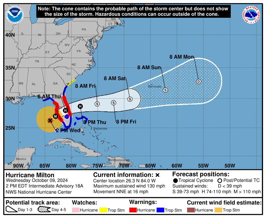
Hurricane Milton is nearly 130 miles (210 kilometres) west of Ft. Myers and has a maximum sustained wind of 130 m.p.h. (215 km/h), still placing it at a Category 4 storm.
The storm “is growing in size as it moves closer to the west coast of Florida,” the National Hurricane Center wrote in an updated advisory.
The centre added that storm surge warnings have been dropped north of Altamaha Sound, Ga. to Edisto Beach, S.C., but are still in effect in several west-coast areas, including Tampa Bay.
 (NHC)
(NHC)
2:10 p.m. EDT: Air Canada cancels some Florida-bound flights
Several Air Canada flights to Florida have been cancelled, the airline announced on Wednesday.
All flights to cities including Fort Myers, Orlando, Fort Lauderdale and Tampa have been cancelled until at least the end of the week when the storm is expected to move over Florida into the Atlantic Ocean.
The airline said it is offering a flexible rebooking policy and adding 1,100 seats after the storm passes.
At least five Florida airports have closed in anticipation of the storm, including Tampa Bay, Orlando, Fort Myers, Sarasota, and St. Petersburg.
1:50 p.m. EDT: Major bridges closed to traffic
Tampa's Florida Highway Patrol announced that major bridges have been closed to traffic.
This includes the Skyway Bridge, the Howard Frankland Bridge, the westbound Gandy Bridge and the westbound Courtney Campbell Bridge.
"The public is NOT allowed to cross the bridges once they are closed and should NOT cross the bridges, even if there are no physical barriers or officers there," Florida's Department of Transportation said.
U.S. Gov. Ron DeSantis said tolls have been waived on state highways to facilitate movement for residents who have been asked to evacuate affected areas.
1:30 p.m. EDT: 'You are most likely going to lose power'
During a Wednesday afternoon briefing, U.S. Gov. Ron DeSantis warned of the likelihood of losing electricity for residents in the storm’s path.
“You are most likely going to lose power,” he said.
“All these folks are going to be brought to get the power back on as soon as possible.”
He added that more than 50,000 power line workers are ready to help restore electricity in the state.
 Florida Gov. Ron DeSantis holds a briefing on Hurricane Milton in Tallahassee, Fla., Wednesday, Oct. 9, 2024.
1:20 p.m.: Storm surge begins
A livestream has captured what appears to be the beginning of a storm surge on the southwestern coast of Florida.
A camera positioned at the Naples Pier shows “water levels steadily rising during what should be *low tide*,” according to a social media post by the National Weather Service’s Miami bureau.
1:10 p.m. EDT: Curfew enacted in Charlotte County
Charlotte County, nearly 100 miles (154 kilometres) south of Tampa, has enacted a curfew from 9 p.m. to 6 a.m. effective tonight, according to the county’s government website.
The curfew also includes a ban on the sale of alcohol during that time, until the curfew is rescinded.
"Although I recognize the frustrations that come with enacting a curfew, this is a means of protecting the people and property of Charlotte County during and following Hurricane Milton,” said Charlotte County Sheriff Bill Prummell. “As soon as it is safe, I will recommend the order be rescinded. Until that time, the only people who should be out on the roadways during those hours are essential workers as they strive to assess damage and provide assistance to those in need and people travelling to and from work.”
1:00 p.m. EDT: Biden warns against price gouging
U.S. President Joe Biden on Wednesday said his administration was going to pressure companies to keep prices stable as Hurricane Milton drenches Florida, so that people can access gasoline, flights and other necessary goods without overpaying.
By Nandita Bose and Gabriella Borter from Reuters
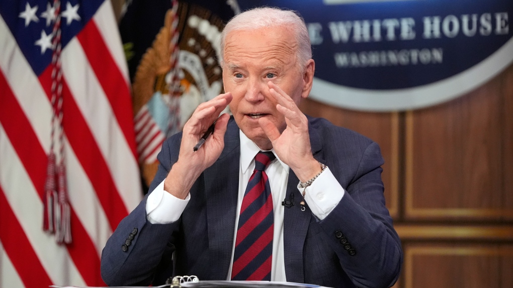 U.S. President Joe Biden speaks during a briefing about preparations for Hurricane Milton and the response to Hurricane Helene in the South Court Auditorium on the White House complex in Washington, Wednesday, Oct. 9, 2024. (Mark Schiefelbein / AP Photo)
11:50 a.m. EDT: 'Several' tornadoes likely through the day
Several tornadoes are likely today and tonight across central and southern Florida, according to the U.S. National Hurricane Center (NOAA).
Meanwhile, Hurricane Milton continues its path towards the west coast. An 11 a.m. NOAA forecast predicts landfall by Wednesday night. It’s expected to move over the peninsula and continue into Atlantic waters on Thursday. It remains a Category 4 storm.
11:10 a.m. EDT: Tornadoes spotted in south Florida
Several tornados have been confirmed this morning in southern Florida, the National Weather Service’s (NWS) regional bureau wrote on social media.
Three active warnings are in effect covering Collier County on the southwest coast and a large area south of Lake Okeechobee in south-central Florida. Up-to-date information on those warnings is available here.
 This image posted by the U.S. National Weather Service's Miami bureau appears to show a tornado crossing Interstate 75. (Source: NWS Miami via X)
“TAKE COVER NOW!” reads the NWS alert. “Move to an interior room on the lowest floor of a sturdy building. Avoid windows. If you are outdoors, in a mobile home, or in a vehicle, move to the closest substantial shelter and protect yourself from flying debris.”
10:35 a.m. EDT: 170,000 available shelter spots, says DeSantis
“It’s not the Four Seasons, but there are things there to make it tolerable,” Florida Gov. Ron DeSantis told a group of reporters Wednesday morning.
He’s describing the six state-run shelters available for residents in Milton’s path. Each of them is equipped with generators and Starlink internet. There are nearly 150 other general population shelters and 36 special needs centres available for people to weather the storm.
In total, there are 200,000 available spots. So far, just 31,000 people have checked in.
DeSantis advertised the shelters during a news conference with other emergency officials. He listed the various teams and supplies that have been deployed ahead of Milton’s landfall: 26 teams ready to perform search and rescue, 11,000 feet of flood protection systems and 500 out-of-state police officers.
He followed the latter statement with a word for anyone planning to loot abandoned buildings: “Don’t even think about it. We are going to come down hard on you.”
9:20 a.m. EDT: Towns on Florida’s coasts preparing for the worst
Sandbags and large sheets of chipboard line the streets of Fort Myers Beach, a small town on the southwest Florida coast, Reuters video shows. A sign is stuck to storefront window: “Stay safe. Downtown Fort Myers Strong.”
Many have already left the town after local leaders issued a mandatory evacuation notice. Residents are used to extreme weather – and many are still dealing with significant loss from previous storms.
"We stayed during Ian and literally watched my roof tear off my house, and it put a turmoil in us," said Jamie Watts, who lives in Fort Myers Beach.
The town was hit hard by Hurricane Ian in late September 2022. Houses were flattened. During a CNN interview at the community’s fishing pier, which had been reduced to its bones, Mayor Kevin Anderson described the scene as “horrific” at the time.
Today, residents face Milton, a potentially larger storm.
“This time, we're going to be a little safer,” said Watts.
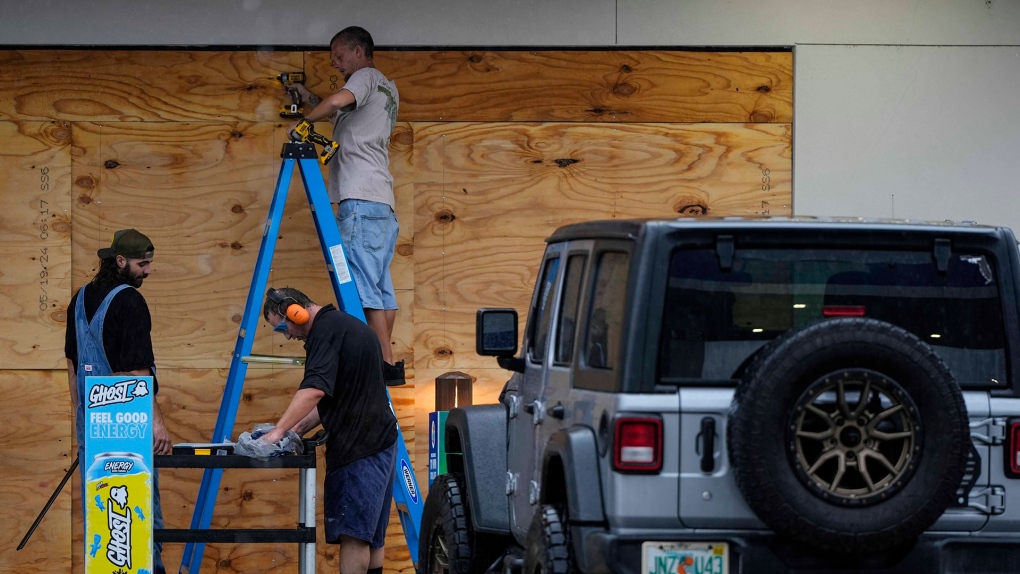 People board up a convenience store ahead of Hurricane Milton, Wednesday, Oct. 9, 2024, in Brandon, Fla. (AP Photo/Mike Stewart)
8:30 a.m. EDT: Milton now a very-fast Cat. 4 storm
Milton is now considered a Category 4 storm – a downgrade from the previous Category 5 status, which is the maximum level on the Saffir-Simpson Hurricane Wind Scale.
However, Milton’s windspeeds are still very fast. Maximum sustained winds are near 250 km/h (155 mph), according to the U.S. National Hurricane Center’s (NOAA) 8 a.m. update.
A Category 5 storm must have sustained winds of 252 km/h or higher. Milton was just two km/h shy of that by mid-morning.
At those speeds, “Most of the (affected) area will be uninhabitable for weeks or months,” according to the NOAA. Homes will be damaged or destroyed. Most trees will be uprooted. Power poles will fall.
![]() (Source: NOAA)
(Source: NOAA)
Hurricane-force winds are expected to extend 45 kilometres (30 miles) from the centre of the storm. Tropical-storm-force winds are likely to extend 205 kilometres (125 miles) outward.
Here’s a breakdown of the Saffir-Simpson Hurricane Wind Scale.
8 a.m. EDT: Prisoners relocated
At least 4,636 Florida inmates from dozens of institutions have been relocated to “hardened” locations ahead of Milton’s arrival.
CTV News has reached out to the Florida Department of Corrections (FDC) to confirm whether there are any prisoners still located in high-risk areas.
“Evacuation determinations are made in the best interest of the public, staff and inmate safety. In the event of evacuations, announcements will only be made upon completion,” reads a statement on the FDC’s website.
“FDC is working alongside our state and local partners in emergency management to monitor the storm and make the appropriate preparations.”
Visitations have been cancelled statewide until Sunday.
7:20 a.m. EDT: How to send a text without service
Milton is expected to knock out electricity and potentially disrupt communications infrastructure. Local officials say people should ensure their devices are charged. If you find yourself without service, there are other ways to get connected.
Apple's iPhone 14 and newer models are capable of sending emergency SOS messages while off-grid via satellite messaging. Apple has posted instructions on how to do it here. You can also share your location on the ‘Find My’ app via satellite. Here’s how.
Some Google Pixel users can use the Satellite SOS function to call 911. A detailed guide is available here. Note – the function is only available to users in the U.S. on Pixel 9, Pixel 9 Pro, Pixel 9 Pro XL, and Pixel 9 Pro Fold devices only.
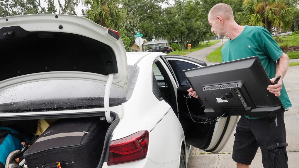 Josh Parks loads his television in his car as he prepares to evacuate to his daughters home in advance of Hurricane Milton, Wednesday, Oct. 9, 2024, in Port Charlotte, Fla. (AP Photo/Marta Lavandier)
6:35 a.m. EDT: Some choose to stay
“I’ve been through it before,” Venice, Fla., resident Tommy Hall told the Associated Press, referring to his experience in previous hurricanes. “You learn from them, and I have, over the years.”
With a generator full of gas, a stockpile of batteries and a fridge stocked with orange juice, frozen burritos and pizzas, he says he plans to weather the dangerous storm ahead despite living in Sarasota Country, where a sweeping evacuation order is in place.
Local leaders have not been vague in their advice to Floridians in evacuation zones.
"If you choose to stay in one of those evacuation areas, you are going to die," Tampa Mayor Jane Castor told CNN on Tuesday.
U.S. President Joe Biden told reporters in Washington, D.C. that Milton “could be one of the worst storms in 100 years to hit Florida.”
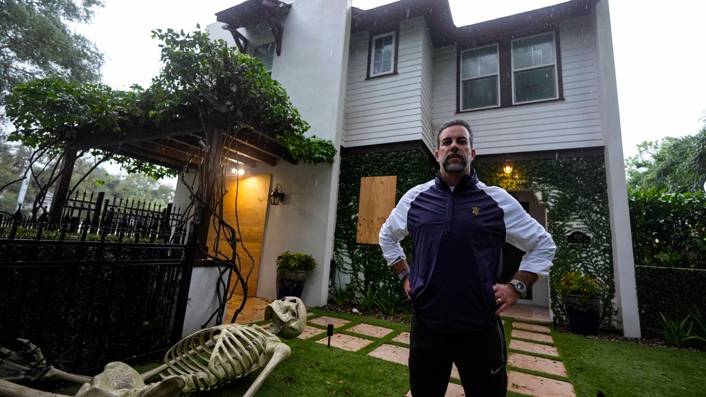 Rick Mijares, poses for a photo in front of his home ahead of Hurricane Milton, Wednesday, Oct. 9, 2024, in Tampa, Fla. (AP Photo/Mike Stewart)
6 a.m. EDT: Gas shortages, landfall possible within 24 hours
U.S. forecasters say the storm could make landfall within 24 hours and reach the eastern coast on Thursday. On Tuesday, local leaders repeatedly called on residents to leave, leading to serious congestion on northbound roadways and gas shortages.
“There have been a lot of lines at gas stations,” Florida Gov. Ron DeSantis told reporters on Tuesday. He says highway police have been authorized to escort fuel trucks to restock gas stations that have run out. While there may be gas shortages at certain locations, there is supply available, DeSantis said.
After more than 24 hours of major slowdowns on the interstate, Google Maps traffic data suggests major roadways north of Tampa are clear so far this morning.
Meanwhile, response crews have been working to clear debris left by Hurricane Helene just two weeks ago from neighbourhood streets.
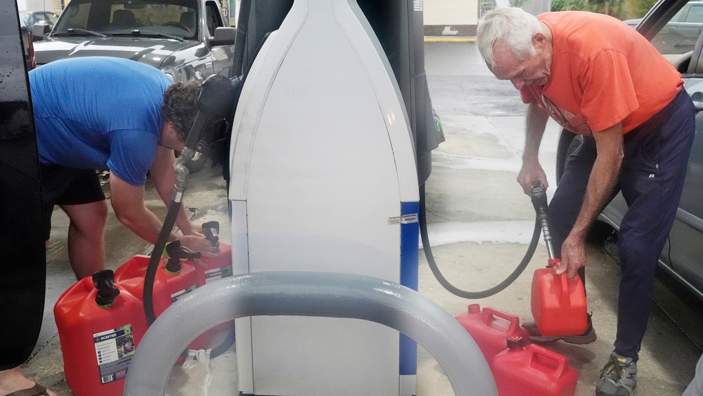 Don Hallenbeck, right, fills gas tanks as he prepares to stay in his home in advance of Hurricane Milton, Wednesday, Oct. 9, 2024, in Port Charlotte, Fla. (AP Photo/Marta Lavandier)
5:15 a.m. EDT: The eye is picking up speed
Milton’s eye is now in the eastern waters of the Gulf of Mexico, northwest of Havana. It is expected to pick up some speed as it continues to move northeast towards the coastline – a densely populated part of the state.
Residents of Tampa and the surrounding area have been told to leave their homes. The waters of Tampa Bay could reach 10-15 feet above ground level should a storm surge occur at the same time as high tide.
![]() The forecast path of Hurricane Milton as of 5 a.m. EDT. (Source: NOAA)
The forecast path of Hurricane Milton as of 5 a.m. EDT. (Source: NOAA)
CTVNews.ca Top Stories

Trudeau's 2024: Did the PM become less popular this year?
Justin Trudeau’s numbers have been relatively steady this calendar year, but they've also been at their worst, according to tracking data from CTV News pollster Nik Nanos.
Manhunt underway after woman, 23, allegedly kidnapped, found alive in river
A woman in her 20s who was possibly abducted by her ex is in hospital after the car she was in plunged into the Richelieu River.
Death toll in attack on Christmas market in Germany rises to 5 and more than 200 injured
Germans on Saturday mourned both the victims and their shaken sense of security after a Saudi doctor intentionally drove into a Christmas market teeming with holiday shoppers, killing at least five people, including a small child, and wounding at least 200 others.
Overheated immigration system needed 'discipline' infusion: minister
An 'overheated' immigration system that admitted record numbers of newcomers to the country has harmed Canada's decades-old consensus on the benefits of immigration, Immigration Minister Marc Miller said, as he reflected on the changes in his department in a year-end interview.
Wild boar hybrid identified near Fort Macleod, Alta.
Acting on information, an investigation by the Municipal District of Willow Creek's Agricultural Services Board (ASB) found a small population of wild boar hybrids being farmed near Fort Macleod.
Summer McIntosh makes guest appearance in 'The Nutcracker'
Summer McIntosh made a splash during her guest appearance in The National Ballet of Canada’s production of 'The Nutcracker.'
The winter solstice is here, the Northern Hemisphere's darkest day
The winter solstice is Saturday, bringing the shortest day and longest night of the year to the Northern Hemisphere — ideal conditions for holiday lights and warm blankets.
Back on air: John Vennavally-Rao on reclaiming his career while living with cancer
'In February, there was a time when I thought my career as a TV reporter was over,' CTV News reporter and anchor John Vennavally-Rao writes.
It's eggnog season. The boozy beverage dates back to medieval England but remains a holiday hit
At Scoma's Restaurant in San Francisco, this holiday season 's batch of eggnog began 11 months ago.
Local Spotlight

School custodian stages surprise for Kitchener, Ont. students ahead of holiday break
He’s no Elf on the Shelf, but maybe closer to Ward of the Board.
'Theodore Too' refloated after partial sinking in St. Catharines
The life-size replica of Theodore Tugboat, Theodore TOO, is upright again after suffering a partial sinking Tuesday.
Appeal dismissed in Sask. 'thumbs up' emoji case
An appeal to a legal case that made international headlines has been dismissed by Saskatchewan's highest court.
B.C. man drops camera into ocean, accidentally captures 'breathtaking' whale video
Before it turned into an extraordinary day, Peter Mieras says it began being quite ordinary.
Freezing rain turns streets into skating rinks, literally in this Sask. community
They say the world is your oyster, and the streets are your stating rink – or at least they are in this Saskatchewan community.
Caught on camera: Porch pirate steals dirty diapers from Edmonton step
A would-be thief got away with a bag of dirty diapers after snagging what they thought was a package off an Edmonton porch.
Saskatchewan art gallery hopes to find artist of pristine Tommy Douglas mural
For the last five years, the Weyburn Art Gallery have been trying to find any information relating to the artist behind a massive mural they found of Tommy Douglas.
Canadian hero Terry Fox being featured on next $5 bill
The federal government is paying tribute to Canadian hero Terry Fox by featuring him on the next $5 bank note, officials revealed Monday.
Son of Ottawa firefighter battling cancer meets his hero Sidney Crosby
The son of an Ottawa firefighter had the chance of a lifetime to meet one of hockey's greatest players.


